
Backpacking the Four Lakes Loop in California’s exquisite and rugged Trinity Alps to explore one of its most beautiful areas.

Chris & Mac
We outventure to help you outventure!
For us, outventuring isn’t just about adventure. It’s about the quiet moments — the first light on a ridgeline, the sound of a creek at camp, the shared laughter when the trail gets spicy. We believe the outdoors enriches people’s lives, and we want to help more folks experience that connection. Learn more about us HERE.
Scroll down for full slideshow.
Length: 25+ Mile Out & Back With Loop (includes side trip to Echo Lake)
Trailhead(s): Long Canyon Trailhead
Elevation Gain: 7,390′
Trail Type: Out & Back With Loop
Dogs: Allowed
Difficulty: Moderate to Strenuous
Permit Required? Yes – Free – Wilderness Permit & Campfire Permit (See Permit Information Below)
Considerations: Winter Trailhead Closures; Bears; Rattlesnakes
Season: Open Year Round; Best in Summer
Overview
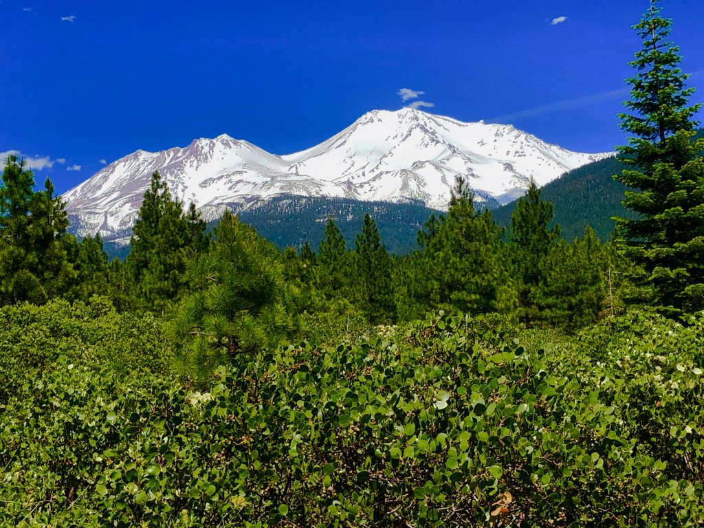
California’s rugged Trinity Alps are exquisite, and the best way to explore one of its most beautiful areas is to backpack the Four Lakes Loop.
BACKPACKING THE TRINITY ALPS
The Trinity Alps in California are a treasure to those who explore on foot. Many picturesque streams, meadows, rocky peaks, and lakes are nestled within the Trinity Alps, and everything is stunningly gorgeous. Additionally, the plentiful variety and display of vibrant summer wildflowers blanketing meadows and hillsides is mesmerizing. Because many of these delights are tucked away far from car accessible trailheads, backpacking the Trinity Alps is the best way to experience these incredible scenes of beauty. One of the more popular backpacking trips here is through the Four Lakes area, and it is simply breathtaking.
FOUR LAKES LOOP ACCESS
The Four Lakes Loop Trail is not accessible via a road. To access the Four Lakes Loop Trail for our backpacking adventure we parked at the Long Canyon Trailhead (lots of parking, but fills quickly) and hiked up to it on the Long Canyon Trail. Make no mistake about this adventure. . . to complete the loop from this trailhead is a 20 mile strenuous round trip hike. In other words, don’t try to day hike it. Instead, take a couple of days to enjoy the Trinity Alps. It is a memorable backpacking trip.
Long Canyon Trail
To get to the Four Lakes Loop from the Long Canyon Trailhead we hiked over 6 miles with roughly 4,000 feet in elevation gain on the Long Canyon Trail. The trail climbs steadily up Long Canyon through a nice forest with no views for about three miles. After it gets clear of the trees the trail is shrouded by tall vegetation as it traverses the far end of the canyon through a meadow. Once it emerges from the overgrowth it ascends through rocks surrounded by wildflowers. The thick display of flowers left my head spinning and my mouth grinning – and this was only the first of many such displays we would see.
As the trail continues climbing there are a few respites of flatter trail and a few areas with trees. We took advantage of the trees. We rested in the shade and ate lunch before our final push up to Deer Creek Pass.
FOUR LAKES LOOP TRAIL
The Long Canyon Trail terminates at the Four Lakes Loop Trail. Here is the first glimpse of Deer Lake, Siligo Peak, and the valleys and peaks that lay beyond it. Arriving at the Four Lakes Loop Trail got us pumped. Although fatigued after the nearly 5 hour climb up, we perked up at the sights before us. We were also thrilled we were near our target of Summit Lake. A short hike on the Four Lakes Loop Trail and we would be there. Camping at Summit Lake would allow us to take as much time as we wanted to complete the loop the following day – it would only be a bit over 5 miles.
After a brief rest we hiked up and over the saddle below Siligo Peak. It was a short .7 mile hike on the Four Lakes Loop Trail to get to the spur trail leading down to Summit Lake.
Camp 1 – Summit Lake
Our hike to Summit Lake from the trailhead was 7.67 miles. Arriving mid afternoon, we found most of the campsites were occupied. We saw two open sites. One “okay” site sat well above the lake, and one beautiful site was down by the lake. One was private and flat, the other was not. We chose the lake site even though it was not level and had zero privacy. We found two tiny mostly level spots to pitch our tents, and we said a lot of “hello’s” to those heading down to collect water or take a swim. All in all, it was a lovely campsite that we thoroughly enjoyed.
On a side note, the talk of rattlesnakes on this loop is no joke. That afternoon another backpacker came over to alert us to one curled up in the rocks between his campsite and the lake.
Hiking The Loop
The loop is fantastic! Whereas some backpackers leave their packs behind and return to their starting point, we did not. We donned our packs and headed out on the loop for our second target for camping: Deer Lake. We recommend hiking the loop clockwise like we did. . . the many beautiful vistas just keep coming.
The first is achieved quickly after regaining the main trail above Summit Lake. After climbing gently to another saddle below Siligo Peak, there are stunning of views of Diamond Lake and beyond. Plan to spend a bit of time getting down to the lake on the series of long, rocky switchbacks. To our delight, we were surrounded by wildflowers all the way down. Sunlight crept slowly up the hillside, gradually illuminating the otherworldly scene we witnessed throughout our descent.
♦ Diamond Lake & Luella Lake
From above, Diamond Lake is surrounded by a sea of green. Upon reaching lake level, we see why – it is very wet. We saw one small group of backpackers camping as we passed through. They probably snagged the only viable spot to camp, but perhaps with some diligent scouting another might be found. The area around the lake is very marshy and we rock hopped as much as we could to avoid the wet muddy ground.
Soon we were past the mud and climbing up more switchbacks – this time through some trees. Not terribly strenuous, the trail goes up above Luella only to descend once again via long switchbacks on open slopes surrounded by wildflowers. Luella Lake is pretty, but we saw no established campsites. Passing by the lake we continued our descent and soon arrived in beautiful Deer Creek Meadow in Deer Creek Canyon.
♦ Deer Creek Canyon and Round Lake
The long range views are beautiful on the hike through the Deer Creek Canyon meadow. Seven-Up Peak and the Dolomite Ridge are a gorgeous wall of rock, and lush meadow vegetation engulfs the trail. Once again we are surrounded by a sea of green dotted with rocks and wildflowers. Round Lake lies in this overgrown meadow, but there was no evidence of a spur trail leading to it. In fact, we did not see Round Lake until we were looking down on it from above.
At the end of the meadow we encountered the strenuous part of the loop. To get back to Deer Lake we have to ascend again. It’s not terribly long, but it is steep. Correspondingly, we took a few rest stops where we found shade. It took about three hours to complete the loop, and we arrived at Deer Lake before noon. Our early start allowed us to avoid hiking in the afternoon heat.
Camp 2 – Deer Lake
Upon reaching Deer Lake we immediately sought shelter from the hot sun. Wasting no time, we headed towards a small stand of trees casting shade on the big rocks beneath them. We avoided stepping on the vegetation between trail and shade by keeping feet on the many rocks littering the area. Dropping our packs on the rocks we ate lunch and surveyed the situation. Two backpackers with a dog were set up at the other end of the lake. No one else was here. We scouted around and set up camp on a wonderful site overlooking the lake with more than enough room for two tents.
Along with the other two backpackers, and one solo female backpacker, there were only five of us who spent the night at Deer Creek Lake.
♦ Heat & Bears
We spent the afternoon in the shade staring at the beautiful surrounds of the lake and the wildflowers. We moved around as needed to follow the shade. It was hot, hot, hot! Because it was so hot we snacked on salty trail mix and downed a few rounds of filtered water mixed with hydration packets. We watched other backpackers hike through that day. Though they came from both directions everyone stopped to re-fuel and re-hydrate. Many also took a dip in the lake.
We also chatted with the two backpackers with the dog. They stopped by our shady spot to let us know a bear was poking around their campsite the night before. We asked if they knew what drew the bear to their site. They told us they found food scraps in the fire ring in their campsite. Yup, that was why the bear was nosing around. Since they were spending a second night at Deer Lake we concurred that scouting for a different location for their tent was a good idea.
The sun setting behind Siligo Peak that night was serene. We thankfully had no bear visits.
STONEY RIDGE TRAIL
The Four Lakes Loop was not the end of our tour of the beautiful Trinity Alps. We had one more target: Echo Lake. We once again got off to an early start due to the heat. After climbing up to the ridge above Deer Lake and bidding farewell to the gorgeous scene below, we set off on the Stoney Ridge Trail. Following a quick descent, we passed through Siligo Meadows. The scrubby vegetation all around us was dotted with rocks and wildflowers. The valley below had meadows as well, but they were very different. They were filled with multiple pools of water surrounded by bright green vegetation.
Eventually the trail begins ascending again. Preceding the climb there is a large, shady campsite near a stream.
Little Stonewall Pass
After crossing the stream, we climbed briefly under tree cover. Trees gave way as we ascended in earnest up Little Stonewall Pass. The views are really huge on this climb. As we went up the rocky trail we were totally blown away. Red-orange rocks on the hillside were packed full with an exceptionally exquisite and vibrant display of wildflowers. The purple and yellow blossoms were stunning, and the view looking back across the valley and the peaks beyond was one of the most beautiful I have ever seen. In fact, from the top of the pass views are outstanding in both directions. On this hike we were thrilled to discover that the Trinity Alps are just as beautiful outside of the Four Lakes Loop.
After reaching the top of Little Stonewall Pass the trail descends again. Unfortunately for us, we descended a bit too far.
Spur Trail to Echo Lake
A small spur trail to Echo Lake leads off of the Stony Ridge Trail as it descends from Stonewall Pass. It eventually became obvious we had missed it on our way down. We knew in advance the approximate distance between Deer Lake and Echo Lake, and we had surpassed that mileage. We stopped to discuss the situation. Had vegetation overgrowth covered up the spur trail? What if we could not find it? We decided we would backtrack to the campsite by the stream if we couldn’t locate it. Unwilling to throw in the towel, and with lots of daylight left, we were determined to find Echo Lake.
Surveying the terrain and consulting our app led us to conclude Echo Lake lay somewhere in the rockiness above our current position. We turned around and headed back up the trail. Soon enough we came upon a very visible rock cairn and a very visible worn foot path – not overgrown. This was the spur trail to Echo Lake. We shook our heads – how did we miss this?? Clearly we were both distracted and looking elsewhere when we passed this by. Did I mention this area is really, really pretty?
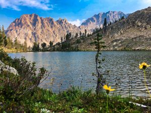
ECHO LAKE
After hiking the quarter mile long spur trail past a picturesque unnamed tarn we reached Echo Lake. It was well worth our time to make this detour off of the Four Lakes Loop for a day. No one was there but us. We immediately saw a few campsites, but none of them worked well for two tents. Spotting a foot path skirting the shore around the lake, we set off to look for other campsites. Our additional steps were rewarded. We found an outstanding site at the far end of the lake. The many flowers dotting the edges of the trail leading to it were an added bonus. So lovely!
Similar to Deer Lake there is little tree cover at Echo Lake. In other words, not much shelter from the relentless sun. After quickly pitching our tents we headed for a small stand of trees on the hill behind our site. Stepping on rocks to reach them, and watching carefully for any sign of rattlesnakes, we climbed up and spent a lazy afternoon hanging out – out of the sun.
Peaceful Beauty
From our vantage point at the far end of Echo Lake we could see where the large blocks of rock littering the area had broken off from the peaks above. Evidence of huge rockfalls here is impressive. One such jumbled run of gigantic boulders which tumbled down long ago hides the stream which feeds the lake. The run to the lake below the boulders is perfect to gather water. Once the sun sank lower we strolled back to the other end of the lake. An amazing overlook there has endless views out into the valley. The sunset that night was outstanding.
Other than a few backpackers who stopped here for a swim and a rest before continuing to wherever they were heading, we had the lake all to ourselves. How often does that happen? We thoroughly enjoyed our time lingering in the peaceful beauty we found at Echo Lake.
The Hike Back
The next morning we retraced our steps back up to Deer Creek Pass. This was not our intent.
Our plan was to bypass Deer Creek Pass and follow the trail cutting across Siligo Meadows up to the Long Canyon Trail. However, upon arriving at the marked juncture in the meadow we could not find the trail. After poking around for awhile the trail was just not obvious. We discussed going for it anyways because we knew which direction we needed to go and perhaps we would eventually hit the trail. That meant traveling through the meadow off trail at least for awhile – longer if we did not locate the trail. As practitioners of “leave no trace” that was a deal breaker. We thus hiked back up to Deer Creek Pass to pick up the Long Canyon Trail for our hike back down to the trailhead.
PERMIT INFORMATION
To stay overnight in the Trinity Alps, a wilderness permit is required. In the event a backpacking camp stove will be used, then a campfire permit must also be obtained. Note that campfires may not be allowed in some areas or at certain times – regardless of whether a campfire permit is obtained. Permits are available at outdoor “kiosks” located at the Weaverville Ranger Station (360 Main St; Phone 530-623-2121), the Fire Station at Mule Creek & Coffee Creek (off Hwy 3), and the Fire Station in Junction City (off Hwy 299). After going to the Fire Station at Coffee Creek after driving most of the day and finding no outdoor kiosk (June 2020), we had to drive to the Weaverville Ranger Station to obtain our wilderness permit and campfire permit (for our camp stove) since we were heading out on the trail early the following morning. We recommend calling the fire stations in advance to ascertain the status of their permit kiosks.
Scroll down to learn about the GEAR WE USE and OTHER OUTVENTURES in this area.
Additional Information (Click below to follow links.)
Four Lakes Loop Slideshow
(Click image to expand.)
Gear We Use for Backpacking
To see descriptions of the gear Chris & Mac use for backpacking, as well as links to manufacturers and retailers offering the gear for sale, please CLICK HERE.
Articles About Other Regional Outventures
SAFETY DISCLAIMER: The activities discussed in this website are outdoor activities and, as such, have inherent risks to which participants are exposed. It is not the intent of this website, nor is it possible due to the variability of weather, terrain, equipment, and experience, to detail all of those risks. The information contained in this site is informational, but not instructive nor exhaustive. It is the sole responsibility of the user to ensure he/she is in good health, fully prepared, and fully informed as to dangers before undertaking any of the activities discussed in this website and the user does so at his/her own risk. The user understands that by using this website he/she acknowledges and accepts all risks associated with use of information from this website and participation in any particular activity addressed herein. Please see “Terms of Use” for additional information.
Want to share this article with your friends? Click on the share button below:
Want more?
Get the latest outventure updates by following us on social media . . .

Love to visit your backpacking outdoor travel tips. Thank you for sharing.
Glad you enjoy our posts. Thank you for the positive feedback. Hike on!