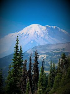
Backpacking the Three Forks Loop – Olympic NP is a multi-day adventure hiking through mossy green forests and lush wildflower meadows, alongside babbling creeks, and over stunning mountain passes.

Chris & Mac
We outventure to help you outventure!
For us, outventuring isn’t just about adventure. It’s about the quiet moments — the first light on a ridgeline, the sound of a creek at camp, the shared laughter when the trail gets spicy. We believe the outdoors enriches people’s lives, and we want to help more folks experience that connection. Learn more about us HERE.
Scroll down for full slideshow.
Length: 42.75 miles
Trailhead(s): Deer Creek Campground
Elevation Gain: 11,366 feet
Trail Type: Loop
Dogs: No
Difficulty: Moderate to Difficult
Permit Required? Yes
Considerations: Bear Hang or Canisters Necessary
Season: Spring-Fall
Overview
Backpacking the Three Forks Loop – Olympic NP is a multi-day adventure hiking through peaceful mossy green forests and lush wildflower meadows, alongside babbling creeks, and over stunning mountain passes.
Three Forks Trailhead at Deer Park Campground
Get to the trailhead for the Three Forks Loop – Olympic NP backpacking adventure by traveling up Deer Creek Road. Like many other dirt roads which take us to amazing places, this one is narrow, winding, and turnouts are small. Pass by the parking area near the ranger station because the trailhead for the Three Forks trail is not there. It is tucked away at the back of the Deer Park Campground, near the walk-in sites.
Day 1: Lower Cameron
The Three Forks trail is a well switched, steady descent down to the Three Forks shelter and camping area. Cross the log bridge spanning Grand Creek there to access the Cameron Creek Trail for this backpacking loop.
Are there steep sections on the Cameron Creek trail? Yes. Short ups and downs? Many. Seemingly endless and relentless, the trail undulates as it rises ever higher. At times obscured by abundant foliage, the trail crisscrosses Cameron Creek many times. Surprisingly, in this beautiful landscape, majestic overlooks do not exist on the Cameron Creek trail from the Three Forks camping area to Lower Cameron. Rocks and trailside logs on which to sit and rest are also in short supply.
Lower Cameron: A Long-Gone Shelter, a Tree, and a Stream
Long ago at Lower Cameron stood an old shelter. Blink, and you might miss its now bare location hiding behind abundant vegetation beside the trail. It is the only clear, flat place to camp on the hillside.
The trail widens here, and a grand tree occupies the opposite side of the trail. It is a welcome place to take a break from the overgrowth to unfurl chairs, ignite a cook stove, and savor the wilderness. Why? Because the tent space across the trail is the only other clear area (excluding the trail itself) and it is a cozy space barely big enough for two.
Meanwhile, nearby, a mountain stream of cold, clear, refreshing water meanders down toward Cameron Creek. Beyond it is an open meadow. Thick vegetation covers any trace of it, but a rock cairn next to the trail in the meadow may mark a path down to other campsites by Cameron Creek.
Day 2: Dose Meadows
The hike to Dose Meadows from Lower Cameron on the Three Forks Loop – Olympic NP is memorable. It is filled with magnificence, and it is tiring. Even so, it is exceptionally satisfying.
From Lower Cameron, the trail continues on to the Grand Pass junction, snaking across meadows (often very overgrown) and through open forest as it climbs. Whereas some head up to Grand Pass at the trail junction, this adventure is not in that direction. Stay left to head towards Upper Cameron Basin and Cameron Pass.
Steepness and Stubbornness Collide: Getting to Upper Cameron Basin
The trail to Upper Cameron Basin transforms past the Grand Pass junction, becoming a scenic work of art. While it is a feast for the senses, it is not all fun and games. This climb is a no joke challenge wrapped in wonders that inspire persistence. Switchbacks? Ha! What are those? In truth, one may wonder if the trail builders lost their switchback manual. Be stubborn and climb on – awesomeness awaits!
Streams and Daydreams in Upper Cameron Basin
The meadows in Upper Cameron Basin are carpets of green adorned with wildflowers. Streams are everywhere, and the trail threads delicately through this delightful tapestry. It is charmingly beautiful, open, and surrounded by mountains. Further, for those wishing to spend a night, campsites are plentiful. Breathe in the dizzying majesty of this basin while hiking through and be aware that many of the footpaths here head to campsites. Although there is a clear path to the left, ignore it. It leads nowhere. Take the trail that heads off to the right. It goes through the meadow at the far end of the camping area and continues to the pass.
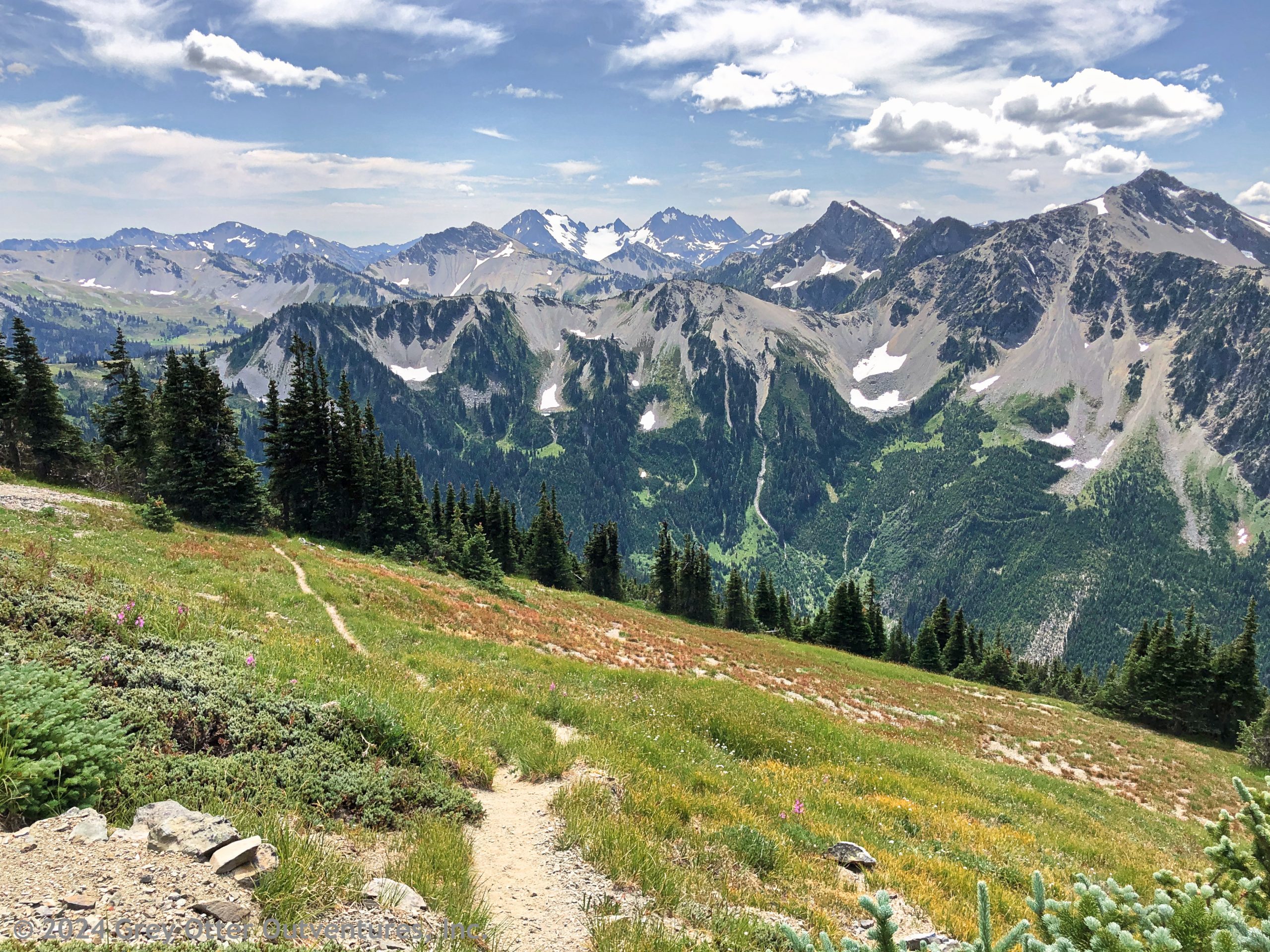
Stunning Summit at Cameron Pass
Ahead and above lies Cameron Pass. It looks stark and unyielding, a neutral expanse of rock and snow fields with a barely visible trail. Steep? Yes, absolutely. Getting up to Cameron Pass is an unrelenting climb, a battle, an extreme scree scramble, a vertical sprint to the sky! Loose scree tests one’s resolve all the way to the top, but that is the price to pay for achieving this goal. Soon, larger rocks near the top suggest the summit of Cameron Pass is close. The edge of the world will soon unfold, and nature’s grandeur will be laid bare.
The Cameron Pass summit instantly entrances one with awe-inspiring vistas of untamed wilderness and endless mountain peaks. The sheer magnitude of the vision is overwhelming. This summit pass transcends mere beauty; it’s an encounter with the most heavenly of sights. Eyes wide, jaws gaping, an involuntary “Oh, holy ****” may escape the lips. However, despite any yearning to linger, the black flies at Cameron Pass are fierce, crushing any desire to hang out for long. This isn’t a bad thing, however, because these incredible views don’t go away on the descent. Get moving to keep the flies at bay.
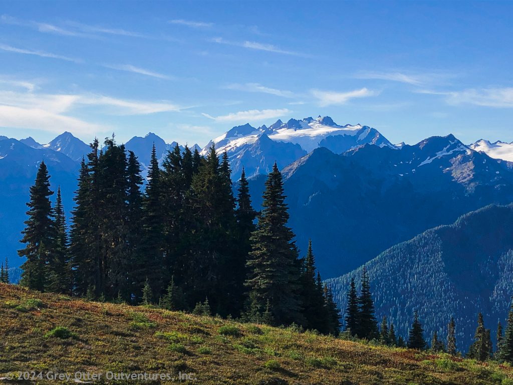
Bonus Views at Lost Pass
Enjoying a lovely view filled descent after climbing all day is delightful. As such, when another ascent is presented, it isn’t exactly greeted with enthusiasm. That is the case on this day because the descent from Cameron Pass gets interrupted briefly. Fortunately, the climb to Lost Pass is not terribly steep, and the views—oh, the views! From Cameron Pass to Lost Pass the scenery is breathtaking.
Then, at long last, comes the final descent. It is like a reverse echo of the intense ascents of the day, with the terrain once again testing one’s resolve. The forest closes in, and the trail descends through steep, rocky, rugged terrain. Happily, the hike down to Dose Meadows from Lost Pass is the last test of the day for weary legs.
Dose Meadows: Bugs and Bears and Deer – Oh My!
Dose Meadows emerges as the forest finally gives way. Hooray! Campsites dot the landscape in this tranquil meadow. The Dosewallips River is near, but access is dodgy from many campsites because a steep incline lies between the campsites and the water. The easiest and safest access to the river is tucked off to the right when entering the meadow. There are a couple of campsites right next to the river, but fellow travelers in search of water are sure to pay a visit. If solitude is essential, choose one of the other campsites.
Besides abundant water, Dose Meadow has bugs. Ah, the relentless companions of summer adventurers. They buzz, they bite, and they maddeningly persist. Dose Meadows, though beautiful and peaceful, harbors these horrible tiny tormentors.
Because Dose Meadows is open and has great water access, one may encounter forest inhabitants also enjoying the area. For example, a black bear appeared in the meadow shortly after everyone woke to began their day. The culprit? Uneaten food discarded a short way away from the meadow by a careless backpacker after dinner the night before likely enticed the bear. It eventually ambled away, up the mountain toward Lost Pass. Shortly thereafter a young deer grazed its way through the meadow. Who knows how many and what other forest creatures may visit Dose Meadows regularly? Keep eyes and ears open, for they are surely present.
Day 3: Falls Camp
The trail from Dose Meadows to Falls Camp unfolds like a well-worn story, each step revealing a new chapter of beauty. Yes, indeed, this day’s chapters are saturated with enchanting sights and sounds.
Dosewallips River to Bear Camp
On the third day of the Three Forks Loop – Olympic NP, backpackers hike from Dose Meadows to Falls Camp, tracing the curves of the Dosewallips River up to the junction for Grey Wolf Pass. There is some bushwhacking (nature’s way of keeping one humble?), but nothing compared to the trials of the prior day.
A couple of miles down the trail, Bear Camp appears. It is an obvious oasis surrounded by abundant foliage. There are a couple of campsites with fire rings, water is plentiful, and it is peaceful. If Dose Meadows is crowded, this is the next best option for an overnight stay in this area.
Sly Grey Wolf Pass
The junction for Grey Wolf Pass is unassuming, so heed this advice. Look for the wooden drainage trench in the trail. The signpost for Grey Wolf Pass is just off trail to the left by the drainage trench. It may be downed and hidden by vegetation, so look for the trench to find the trail to Grey Wolf Pass.
Changing and Captivating Grey Wolf Pass
Switchbacks on the trail up to Grey Wolf Pass reveal lovely views through open hillside meadows adorned with wildflowers. The lower switchbacks are gentle and forgiving. However, nearing the pass, they become steeper, shorter, and rockier. Forest and meadows disappear. Climbing once again demands resolve, though not nearly to the extent of the prior day.
Standing at the summit of Grey Wolf Pass on rock and scree, gazing into the vast valley below, the world seems to slowly exhale. Pause to take in the impressive view before descending on a well-trodden trail. The treat here lies further down in a world of lush green, wildflowers, and water. Descend into this hidden wonder and be amazed by this wonderland.
Serene Falls Camp
Falls Camp is primitive and unassuming. Immediately visible campsites appear as mere footprints in the earth beside the trail. As such, they are not ideal for solitude. Instead of setting up camp here, travel the path toward the falls, take a left turn, and discover an ideal off-trail campsite. The falls murmur in the distance, providing a sweet lullaby for the night. Water flows through here. Collect it where the trail intersects this camping area.
Day 4: Grey Wolf Camp
The journey from Falls Camp to Gray Wolf Camp unfurls through dappled forest. The trail winds between ancient trees, with sunlight filtering through a lush canopy into an open forest covered with moss. Soft and surreal, the brilliant green, thick moss clings to bark and stone, creating a cool, otherworldly tapestry. Even though the Gray Wolf River teases subtle views along the trail, it is the forest’s luxurious velvet cloak, this glorious moss, which steals the show.
Moss and Murmurs at Grey Wolf Camp
Grey Wolf Camp is a blissful place. Here water meets earth and water meets water, whispers blend and more wonders are revealed. On one side of the river, four campsites beckon. Across the footbridge, however, a fifth site looks like a hidden gem. Regrettably, it sits squarely at the crossroads of the Gray Wolf Trail and the path to the pit toilet. If solitude is desired, pick one of the other sites.
The babbling company of murmuring creeks coming together is the soundtrack of Grey Wolf Camp. Time dances to a different rhythm and the world narrows to nothing more than water and moss. Yes, indeed, Grey Wolf Camp is a masterpiece of rushing water where hours can be spent just watching the water flow and soaking in its peaceful serenity.
Day 5: Back to Deer Creek Campground
When morning breaks the trailhead awaits. Cross the footbridge and climb back up to Deer Creek Campground to end this adventure. Is it a relentless finish to the Three Forks Loop – Olympic NP? Yes, but once again the climb is manageable —3,500 feet over 3 miles back up the Deer Creek Trail. Since this is a loop, what was originally the entrance gateway to this adventure, now guides one home.
Scroll down to learn about the GEAR WE USE and OTHER OUTVENTURES in this area.
Additional Information (Click below to follow links.)
Three Forks Loop Slideshow
(Click image to expand.)
Gear We Use for Backpacking
To see descriptions of the gear Chris & Mac use for backpacking, as well as links to manufacturers and retailers offering the gear for sale, please CLICK HERE.
Articles About Other Regional Outventures
SAFETY DISCLAIMER: The activities discussed in this website are outdoor activities and, as such, have inherent risks to which participants are exposed. It is not the intent of this website, nor is it possible due to the variability of weather, terrain, equipment, and experience, to detail all of those risks. The information contained in this site is informational, but not instructive nor exhaustive. It is the sole responsibility of the user to ensure he/she is in good health, fully prepared, and fully informed as to dangers before undertaking any of the activities discussed in this website and the user does so at his/her own risk. The user understands that by using this website he/she acknowledges and accepts all risks associated with use of information from this website and participation in any particular activity addressed herein. Please see “Terms of Use” for additional information.
Want to share this article with your friends? Click on the share button below:
Want more?
Get the latest outventure updates by following us on social media . . .