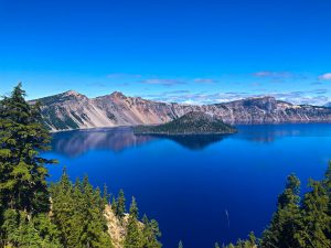
The Maple Pass Loop has stunning views, gorgeous wildflower and fall colors, and is simply one of the most beautiful hikes in the North Cascades .

Chris & Mac
We outventure to help you outventure!
For us, outventuring isn’t just about adventure. It’s about the quiet moments — the first light on a ridgeline, the sound of a creek at camp, the shared laughter when the trail gets spicy. We believe the outdoors enriches people’s lives, and we want to help more folks experience that connection. Learn more about us HERE.
Scroll down for full slideshow.
Length: 7.1 Mile Loop
Trailhead(s): Rainy Pass Picnic Area
Elevation Gain: 2,079′
Trail Type: Loop
Dogs: Allowed – Not Advised
Difficulty: Moderate to Strenuous
Permit Required? Yes. $5 Day Pass Payable at Trailhead or Northwest Forest Pass or America The Beautiful Pass
Considerations: Elevation/Snow
Season: August-Oct (Best)
Overview
Cherished memories await those who hike the Maple Pass Loop. The beautiful and dramatic scenery is stunning.
HIKING THE MAPLE PASS LOOP FROM THE RAINY PASS PICNIC AREA
This is a popular picnic area and trailhead, and it although it has a great deal of parking (40 spaces), the lot does fill early. The paved trail which leads to Rainy Lake and to the Lake Ann/Maple Pass Loop Trail is located on the south side of the parking lot.
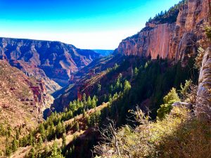
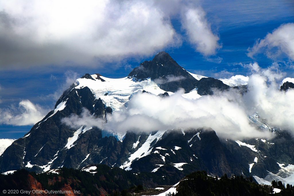
On a clear day hikers on the Lake Ann/Maple Pass Loop Trail get invigorating views of huge mountain peaks under bright blue skies. On the other hand, a cloudy day can impact the views and their aura. If the clouds are high above the mountain peaks the views are incredibly textured and dramatic. If the clouds are low, however, many of the impressive long range views may be hidden. Whether hiking here early or late in the season, on a clear or an overcast day, be prepared to be wowed!
Fortunately the short range views are breathtaking no matter what the skies are doing. In the summer the vibrant wildflowers are stunning in hues of yellow, pink, red, orange, purple, and white. Enjoy them as the trail skirts the side of Lake Ann, in the meadows of Heather Pass, and at the summit of Maple Pass and along the long switchbacks below it. As the season progresses, the enchanting wildflowers fade, but the gorgeous golden tones of fall take over.
Choose a Direction
The direction of travel on this trail is up to you. Because it is a loop, hikers can proceed either clockwise or counterclockwise on the Lake Ann/Maple Pass Loop Trail. No matter which direction you travel, be sure to stop and turn around periodically. Once above the trees, the views in front of you and behind you are ever changing, and they are worth checking out from both directions. Our preferred direction is counterclockwise.
Although the trail travels through the same terrain, the experience hiking from either direction is not the same. Clockwise may be slightly more forgiving on the knees due to a gentler descent overall, but it is definitely a more strenuous way up. Conversely, traveling counterclockwise can be particularly punishing on the knees over the last 2.5 miles the trail descends, but is less strenuous on the way up. We hike this loop counterclockwise because the views get bigger and grander as the trail emerges from the forest before culminating in the unmatched splendor of the endless views from Maple Pass. In other words, it builds splendidly. It all comes down to tolerance and preference. As such, choose your direction and hit the trail because this one is truly a bucket list hike.
» Hike the Loop Clockwise
Choose a clockwise direction for a steeper ascent to the summit of Maple Pass and a gentler descent back to the parking area. The trail begins by following the paved path towards Rainy Lake for roughly a half mile. At the split where it turns to dirt is where the climb begins. Gaining 1,700 feet over 2.5 miles the trail climbs aggressively over several steep switchbacks. Although there are sweeping views once the trail leaves the cover of forest and starts the longer switchbacks up to Maple Pass, the truly spectacular views remain hidden until reaching the pass. The 360 degree views are a delight as the trail meanders through the rock and vegetation strewn shoulder of Frisco Mountain.
Dropping steeply from Maple Pass over a short distance, the trail descends quickly. It then traverses a lovely, steep ridge with great long range views as well as gorgeous views of Lake Ann. The trail then descends to Heather Pass. Be sure to check out Heather Pass for its breathtaking views on the spur trail (marked, on the left as you descend) out through the meadow. Finally, enjoy the last top down views of lovely Lake Ann along a relatively flat stretch of trail before it returns to the forest for the hike back down. Along the way and just 1.25 miles from the end of the loop, a .6 mile round trip detour on a spur trail to Lake Ann. Return to the main trail to get back to the trailhead.
« Hike the Loop Counterclockwise
Alternatively, enjoy a less strenuous ascent, but a more vigourous descent, by traveling this trail counterclockwise. The trail begins with a steady climb through the forest, but the grade is not overly steep. The marked spur trail down to the shore of Lake Ann is on the left. Hikers taking the spur must return to the main trail to continue the loop. When the trail emerges from the forest, picturesque views of Lake Ann fill the scene. At approximately 2 miles in look for the spur trail on the right which leads to the meadows of Heather Pass. Enjoy the breathtaking views and then regain the trail to continue the loop. As the trail ascends in earnest after Heather Pass the climb becomes more strenuous and then traverses a ridgeline offering more incredible views of Lake Ann. After the ridgeline, hikers make the last steep climb up to Maple Pass.
After that it is all downhill. The descent is steep, initially via long switchbacks with beautiful sweeping views. Enjoy the mildness of these switchbacks because once in the forest the trail descends in earnest over the remaining 2.5 miles.
DOGS NOT ADVISED
This trail skirts the North Cascades National Park boundary, but lies fully on National Forest land. It showcases an incredible landscape that is both rugged and fragile. It is a busy trail with fragile vegetation. We noted numerous areas undergoing restoration (they are roped off). Although dogs can use this trail, in order to protect this fragile, irreplaceable landscape, this one is truly best left to human only use.
Scroll down to learn about the GEAR WE USE and OTHER OUTVENTURES in this area.
Additional Information (Click below to follow links.)
Hiking to Maple Pass Slideshow
(Click image to expand.)
Gear We Use for Day Hiking
To see descriptions of the gear Chris & Mac use for day hiking, as well as links to manufacturers and retailers offering the gear for sale, please CLICK HERE.
Articles About Other Regional Outventures
SAFETY DISCLAIMER: The activities discussed in this website are outdoor activities and, as such, have inherent risks to which participants are exposed. It is not the intent of this website, nor is it possible due to the variability of weather, terrain, equipment, and experience, to detail all of those risks. The information contained in this site is informational, but not instructive nor exhaustive. It is the sole responsibility of the user to ensure he/she is in good health, fully prepared, and fully informed as to dangers before undertaking any of the activities discussed in this website and the user does so at his/her own risk. The user understands that by using this website he/she acknowledges and accepts all risks associated with use of information from this website and participation in any particular activity addressed herein. Please see “Terms of Use” for additional information.
Want to share this article with your friends? Click on the share button below:
Want more?
Get the latest outventure updates by following us on social media . . .