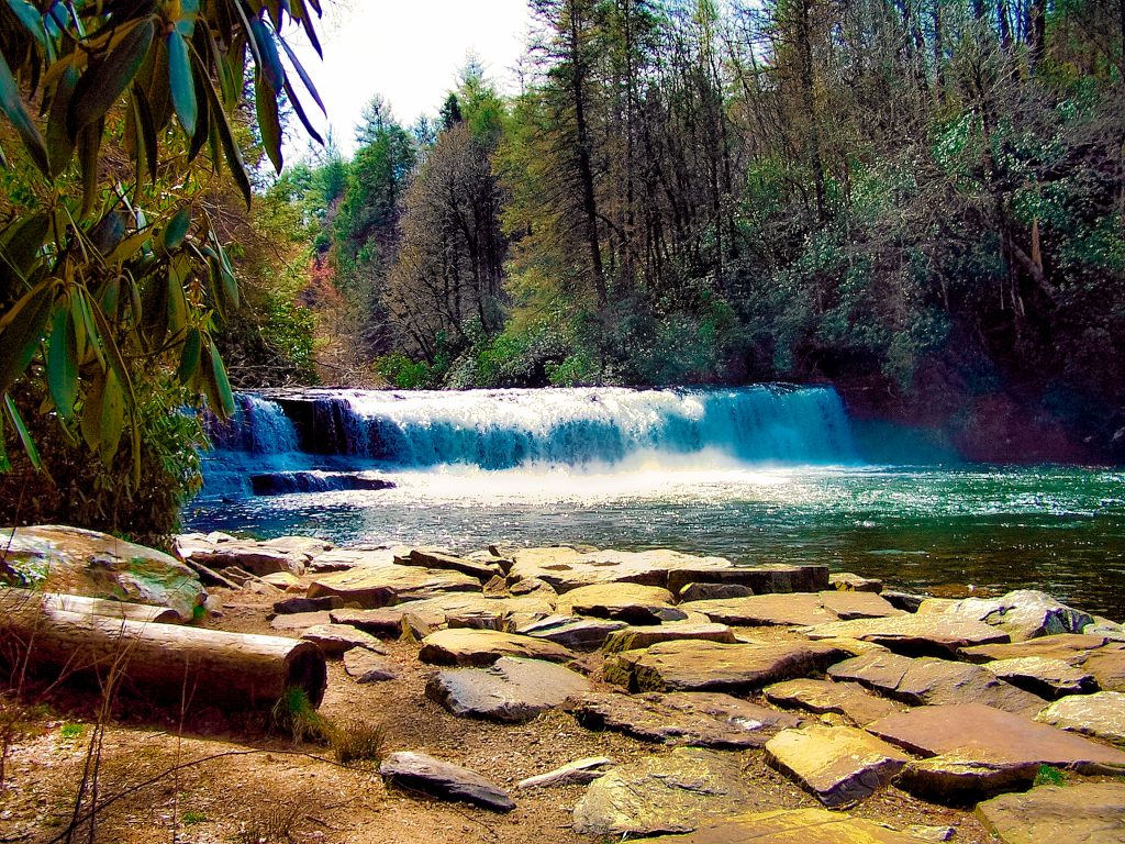
The majesty and serenity of the Blue Ridge Mountains captivate hikers on the balds of Roan Mountain between Carvers Gap and Grassy Ridge Bald.

Chris & Mac
We outventure to help you outventure!
For us, outventuring isn’t just about adventure. It’s about the quiet moments — the first light on a ridgeline, the sound of a creek at camp, the shared laughter when the trail gets spicy. We believe the outdoors enriches people’s lives, and we want to help more folks experience that connection. Learn more about us HERE.
Scroll down for full slideshow.
Length: 5 Miles (approx.) Round Trip to Grassy Ridge Bald
Trailhead(s): Carvers Gap
Elevation Gain: 1,200’ (approx.)
Trail Type: Out & Back
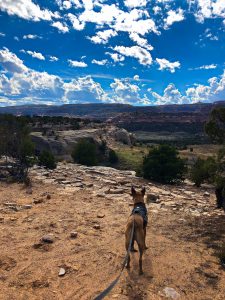
Dogs: Allowed
Difficulty: Moderate
Permit Required? No
Considerations: Exposure/Wind
Season: Year Round
Overview
The majesty and serenity of the Blue Ridge Mountains captivate hikers on the balds of Roan Mountain between Carvers Gap and Grassy Ridge Bald.
THE ROAN HIGHLANDS
Roan Mountain is not a mountain, it is a high ridge containing five mountain peaks of the Roan Highlands in the Unaka Range of the Southern Appalachian Mountains. With its peaks divided east and west by Carvers Gap, those exploring here have a couple of options depending on how they want to spend their time.
West of Carvers Gap, the Roan Mountain Recreation Area (a fee area, closed during the winter) is home to the famous Rhododendron Gardens. This fee area offers hikers the opportunity to explore two short, easy trails. Alternatively, east of Carvers Gap, hikers have the opportunity to explore an exceptional stretch of the Appalachian Trail as it works its way over the balds of the Roan Highlands.
ROAN MOUNTAIN BALDS HIKE
Round Bald
Hiking from the Carvers Gap Trailhead, start off on a 3/4 mile easy climb on a gravel path up to Round Bald. This brief stroll through a delightful spruce-fir forest keeps hidden the treasures of the balds ahead. However, once it emerges out of the forest, panoramic views of endless peaks and valleys unfold to the left and right and the trail becomes more natural underfoot. Because the trail runs along the border between North Carolina and Tennessee, views from here include both states. By now hikers are hooked, and the trail entices them to keep going to Jane Bald.
Jane Bald
The awesomeness of Roan Mountain as it descends and then climbs again between Round Bald and Jane Bald becomes very apparent. This part of the hike is breathtaking due to the flame azalea and rhododendron which flourish and adorn the hillsides, surrounded by numerous varieties of windblown grasses which cover everything else that is not rock.
During the warmer months wildflowers of all hues add interest and rich color to the grasses which are every color of green imaginable. In contrast, in the colder months, the grasses are a lovely hodgepodge of yellow, orange, and brown. Beyond the grasses are gorgeous views of the Blue Ridge Mountains. Following a short descent down from the peak of Jane Bald and the Appalachian Trail bids farewell to Roan Mountain as it heads off towards Yellow Mountain. Hikers depart the Appalacian Trail at the junction between the balds, and take the side trail up to Grassy Ridge Bald.
Grassy Ridge Bald
The final bald peak of this Roan Mountain hike is a windswept jewel. Grassy Ridge Bald has it all – rocks, grasses, wildflowers, native rhododendron, flame azalea, spruce-fir, and stunning views. Wander around on the footpaths to explore, sit on the rocks and stare, and just enjoy this unique and special place. Unless it is very warm, bring a jacket since it is often cool and windy up here.
Since the way back is the same as the way out, the hike back is just as beautiful as the hike out. Because the views are stunning in both directions you will see things you missed on the way out, so don’t despair at having to turn around and head back. This out and back hike is one where we have not once cared that we had to retrace our steps, and we have done this hike a few times. Yes, it is that awesome.
SUNRISES, SUNSETS, RHODODENDRON AND FLAME AZALEAS
Summer Blooms & Autumn Glow
One of the best times for this hike is when the rhododendron and flame azalea are in full bloom. The other is when the hills are covered with vibrant gold, orange, and red fall hues. In either case, the explosion of color is exquisitely abundant and varied. It simply takes your breath away. We lucked out on our first hike on Roan Mountain to discover the rhododendrun and flame azalea in their full glory. It was intoxicatingly beautiful. On a subsequent fall hike we were just as impressed with the red and gold autumn scenery.
Glorious Sunrise
We arrived fairly early the first time we hiked here and met a few hikers with serious photographic equipment. Upon inquiry we discovered they had arrived much earlier in order to photograph the sunrise. We decided we had to check it out for ourselves. A few days later we arrived at Carvers Gap well in advance of sunrise. Our hike out was dark, cold, and wet. Because we wanted to be in place before the sun made it up over the peaks we hiked hard and fast. Our efforts were rewarded. I will never forget the majestic, colorful, and stunning sunrise which unfolded as we sat and watched.
A few years later we had the opportunity to do it again in the fall. It was still dark, cold, and wet, but once again we absolutely loved watching the glow behind the mountain tops on the horizon turn sky and clouds into one of nature’s fleeting masterpieces. Perhaps next time we are in the area we’ll check out a sunset. Rumor has it they are pretty spectacular as well.
Scroll down to learn about the GEAR WE USE and OTHER OUTVENTURES in this area.
Additional Information
Roan Mountain Slideshow
(Click image to expand.)
Gear We Use for Day Hiking
To see descriptions of the gear Chris & Mac use for day hiking, as well as links to manufacturers and retailers offering the gear for sale, please CLICK HERE.
Articles About Other Regional Outventures
SAFETY DISCLAIMER: The activities discussed in this website are outdoor activities and, as such, have inherent risks to which participants are exposed. It is not the intent of this website, nor is it possible due to the variability of weather, terrain, equipment, and experience, to detail all of those risks. The information contained in this site is informational, but not instructive nor exhaustive. It is the sole responsibility of the user to ensure he/she is in good health, fully prepared, and fully informed as to dangers before undertaking any of the activities discussed in this website and the user does so at his/her own risk. The user understands that by using this website he/she acknowledges and accepts all risks associated with use of information from this website and participation in any particular activity addressed herein. Please see “Terms of Use” for additional information.
Want to share this article with your friends? Click on the share button below:
Want more?
Get the latest outventure updates by following us on social media . . .