Hiking the Lost Canyon Loop in the Needles District of Canyonlands National Park is an unforgettable adventure on and around incredible rocks.

Chris & Mac
We outventure to help you outventure!
For us, outventuring isn’t just about adventure. It’s about the quiet moments — the first light on a ridgeline, the sound of a creek at camp, the shared laughter when the trail gets spicy. We believe the outdoors enriches people’s lives, and we want to help more folks experience that connection. Learn more about us HERE.
Scroll down for full slideshow.
Length: 8.5 Mile Lollipop Loop
Trailhead(s): Squaw Flat Trailhead, Needles District
Elevation Gain: 670’
Trail Type: Out & Back with Loop
Dogs: Not Allowed
Difficulty: Moderate
Permit Required? Yes – $35 National Park Entry Fee or Park Pass
Considerations: Heat, Heights, Winter Snow
Season: Year Round
Overview
The Lost Canyon Loop in the Needles District of Canyonlands National Park is a hidden gem filled with adventure and mind blowing beauty.
CANYONLANDS NATIONAL PARK- THE NEEDLES DISTRICT
Located in the southwest corner of Canyonlands National Park, the landscape of the Needles District is dominated by colorful Cedar Mesa Sandstone formations. They are true wonders to behold, and visitors to the Needles District get to see and experience them firsthand.
Some of the best known features and formations in Canyonlands National Park are in the Needles District. Tower Ruin, Confluence Overlook, Elephant Hill, the Joint Trail, and Chesler Park, some of the most well known, are accessible by both foot trail and roads. The roads, however, are so rough and rocky that they require four wheel drive and/or high clearance vehicles.
LOST CANYON LOOP
Fortunately, the Lost Canyon Loop is accessible from a trailhead located on a paved road. Although it can also be accessed from a gated gravel road that requires a permit for travel, the easiest access to the Lost Canyon Loop is from the Squaw Flat Trailhead.
Squaw Flat Trailhead
The parking area at the Squaw Flat Trailhead has an ample supply of parking spaces. Nonetheless, when we arrived at 9:30am there were only a handful of spaces open. By the time we were on the trail, there were no vacant spaces. Consequently, it appears that early arrivals here have the best opportunity to snag a spot.
Peekaboo Trail to Squaw Canyon
The way to Lost Canyon starts at Trailhead “A” on the south side of the road. Almost immediately the trail splits. The Peekaboo Trail to Squaw Canyon splits to the right, and Lost Canyon heads off to the left.
Initially an easy to follow sandy footpath through the flat, open grassland of Squaw Flat, this portion of the Peekaboo Trail is fairly boring and sandy. Soon enough, however, the first hint of the adventure ahead occurs when the trail appears to terminate at a wall of rock. Finding toe and hand holds, we easily climb to find rock cairns and a faint path crossing the top of the rock. This was only the first of several instances that sent us climbing up, walking over, and then climbing back down big rock. Far ahead in the distance we spot a beautiful red rock wall and wonder what’s in store for us on this adventure.
Climbing back down the other side of the rock, we regain sandy path. The scrubby vegetation is low, making for fantastic views. Far off in the distance we see the snow tipped La Sal Mountains, and notice an interesting rock formation along the red rock wall. It looks like a huge white bootie. I’m captivated.
After a little over a mile we reach the junction with Squaw Canyon. The low, scrubby vegetation starts to abate, the trail becomes rockier, and we find some trees have managed to gain a footing in drainage areas. Because we plan to come back this way to complete our loop we bear left and stay on the Peekaboo Trail.
Accessing the Lost Canyon Loop
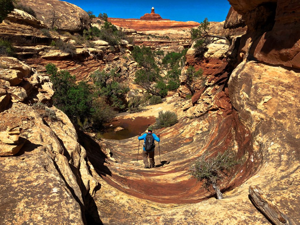
As we proceed, the trail takes us over more rock outcroppings until we finally reach the “big one” which momentarily stops us in our tracks. Are we really supposed to ascend this enormous wall of red slickrock? Yes, we are. We can see two other hikers cruising around on the rock far above us, so we begin climbing. We follow the contours of the rock up because there is little in the way of worn rock or cairns to mark the way. Fortunately it is fairly easy to figure out and we have no difficulty reaching the top.
Up top we stand on a sea of rippling red rock. The views are absolutely amazing. To our right is a tall tower of rock, and to the left a long ledge. Following the red and white ridge to the left which is littered with rocks, we manage to locate the cairns which take us to a short ladder. Climbing down, we remain on rippled rocks and follow more cairns down to the canyon rim. Soon we find ourselves in a sandy wash. Following the wash, and after hiking 2.6 miles from the trailhead, we finally reach Lost Canyon.
Lost Canyon Loop
The biggest surprise of Lost Canyon is that it is filled with vegetation. Unlike the desert environment we traveled to get here, this canyon has water. Thus it has an abundance of vegetation and trees. In some areas where the vegetation is very thick around the trail which makes keeping track of it tricky, but we had no difficulty following it. Otherwise, following the trail was easy, even when the footpaths were less evident for other reasons. For example, at times the trail follows a dry creek run – above it, not in it. As such, when the trail dips up and down to cross back and forth in these places, we find rock cairns often marking the trail on the opposite side.
Although there are a few interesting rock formations in Lost Canyon, its tall, colorful walls and water are what make it special. The water allows trees and other vegetation to take hold here, and they add dramatic contrast and interest to the red and white rock soaring high above. Walking through this “lost canyon” we feel like we are are being taken back in time, and it is absolutely delightful.
Eventually we reach the end of Lost Canyon and must climb back up. In this endeavor we follow cairns once again to ascend through a rougher rocky area that deposits us on the rock rim dividing Lost Canyon and Squaw Canyon. Standing atop this rim we are in awe. Looking down, it is surprising how far we climbed up!
The long range views are magnificent and stunning. We get to enjoy them for nearly a half mile while walking atop the beautiful rock rim. This part of the trail was absolutely fantastic. At the end of it we climb back down and make our way to Squaw Canyon.
Squaw Canyon
In drier territory once again, we see the vegetation in Squaw Canyon is scrubby and low. There are some sparse trees, and a number of interesting rock formations. We stop often to admire the scenery in Squaw Canyon, but move quickly and easily on the 1.7 mile ribbon of sand and rock that takes us back to the junction with the Peekaboo Trail. Completing the loop part of this adventure, we retrace our steps on the Peekaboo Trail to get back to the trailhead.
Climbing back up on the last big rock, I turn to look back wistfully. The beauty of our national parks never fails to stop me in my tracks. I not only pause one last time to appreciate where I’ve been before I leave, I also say a silent “thank you” those who had the foresight to protect it. I am forever grateful. Outventure on!
Scroll down to learn about the GEAR WE USE and OTHER OUTVENTURES in this area.
Additional Information (Click below to follow links.)
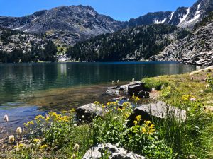
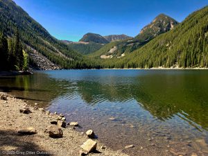
Lost Canyon Loop Slideshow
(Click image to expand.)
Gear We Use for Day Hiking
To see descriptions of the gear Chris & Mac use for day hiking, as well as links to manufacturers and retailers offering the gear for sale, please CLICK HERE.

Articles About Other Regional Outventures
SAFETY DISCLAIMER: The activities discussed in this website are outdoor activities and, as such, have inherent risks to which participants are exposed. It is not the intent of this website, nor is it possible due to the variability of weather, terrain, equipment, and experience, to detail all of those risks. The information contained in this site is informational, but not instructive nor exhaustive. It is the sole responsibility of the user to ensure he/she is in good health, fully prepared, and fully informed as to dangers before undertaking any of the activities discussed in this website and the user does so at his/her own risk. The user understands that by using this website he/she acknowledges and accepts all risks associated with use of information from this website and participation in any particular activity addressed herein. Please see “Terms of Use” for additional information.
Want to share this article with your friends? Click on the share button below:
Want more?
Get the latest outventure updates by following us on social media . . .