Hike Hurricane Ridge to Klahhane Ridge for long range breathtaking views and a stunning landscape that will leave you speechless.

Chris & Mac
We outventure to help you outventure!
For us, outventuring isn’t just about adventure. It’s about the quiet moments — the first light on a ridgeline, the sound of a creek at camp, the shared laughter when the trail gets spicy. We believe the outdoors enriches people’s lives, and we want to help more folks experience that connection. Learn more about us HERE.
Scroll down for full slideshow.
Length: 7.6 Miles Round Trip
Trailhead(s): Hurricane Ridge Visitor Center
Elevation Gain: 2,064’
Trail Type: Out & Back
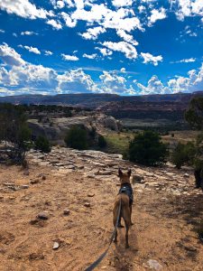
Dogs: Not Allowed
Difficulty: Moderate
Permit Required? Yes – National Park Entry Fee or Valid National Park Pass
Considerations: Weather Related Road Closures in Winter
Season: Year Round
Overview
Hike Hurricane Ridge to Klahhane Ridge for sweeping views deep into Olympic National Park, out to Vancouver Island, and as far away as the North Cascades.
HURRICANE RIDGE TO KLAHHANE RIDGE
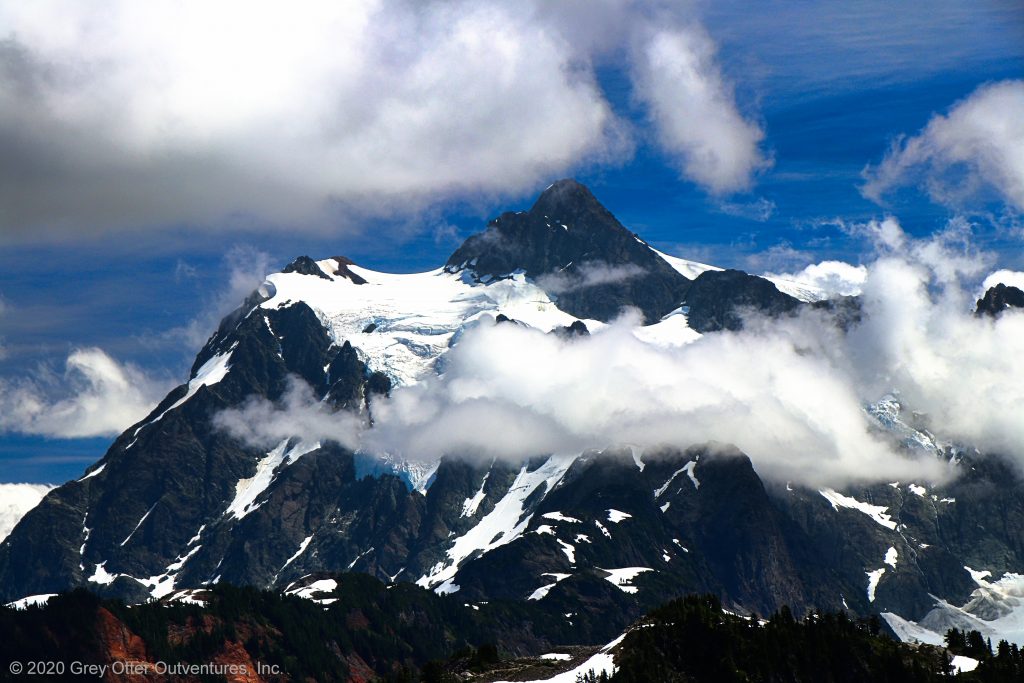
Gorgeous views that fill the horizon are the reason to hike from the Hurricane Visitor Center to Klahhane Ridge. Seriously, this hike is filled endless views that will leave you speechless. For example, on a clear day it is possible to observe Mount Baker in the North Cascades Range.
Once you get to Klahhane Ridge, you can turn around or go on. For instance, if time and energy allow, follow the Klahhane Ridge Trail and drop down to Lake Angeles. Alternatively, extend this hike by crossing Klahhane Ridge and continue hiking out towards Heather Park.
Accessing Hurricane Ridge
To access the Hurricane Ridge to Switchback Trail from the parking area at the Hurricane Ridge Visitor Center follow the High Ridge Nature Trail up towards Sunrise Point. Because the High Ridge Nature Trail makes a loop, climb up by following the trail to either the left or right. To the right has less tree cover and is a little longer, but it offers up some nice long range views. Conversely, the left fork climbs more directly through an interesting and peaceful forest, but it lacks far off views. Either way is fine because no matter which way you go they arrive at the same place.
At the junction where the two ways up meet to form a loop, another trail ascends to the viewpoint at Sunrise Point. The viewpoint offers excellent views of the glorious ridges and valleys beyond. However, we do not climb here because we don’t just want to look at them – we want to explore them. As such, we follow the trail across the steep slope below the viewpoint. It is single file (narrow). In the event others are traveling in the opposite direction, someone needs to step off (above, not below) the trail to let the others pass by.
Hiking Hurricane Ridge to Klahhane Ridge
Once across this steep slope, enjoy the amazing views along Hurricane Ridge. As it heads towards Mount Angeles the trail moves in and out of trees periodically, but most of this ridge is exposed. Until it reaches the Switchback Trail there are some elevation changes, but they are mostly short ascents and descents. The exception is a roughly 350 foot descent on switchbacks that occurs around a mile and a half from the trailhead. Enjoy the tree cover here – it will be very welcome if the day is hot. Other than the final climb up to Klahhane Ridge, this is the biggest elevation change of the hike.
Before reaching the rocky exposed areas of Mount Angeles, the trail crosses a couple of forested ridges. Trees pretty much disappear once the trail drops to cross a major wash coming down from Mount Angeles. This wash is gorgeous, and it is unmistakable because there is nothing else like it anywhere in the area. In fact, the road up to the Hurricane Ridge Visitor Center passes by it. Yup, this enormous wash starts near the top of Mount Angeles and goes right down to and beyond the small Switchback Trailhead parking area on Hurricane Ridge Road.
Shortly after crossing this wash the trail meets up with the Switchback Trail for the remaining climb of roughly 800 feet. This is the final mile, and it switchbacks several times on the way up to Klahhane Ridge.
Klahhane Ridge
From Klahhane Ridge the views extend out past Port Angeles far below to the Straight of Juan De Fuca and Vancouver Island. Take some time to soak it in – you earned it! From here, if desired, the hike can continue in either of two directions. Head right to stay atop Klahhane Ridge and hike towards Rocky Peak. At the far end of Klahhane Ridge, before reaching Rocky Peak, another trail descends to Lake Angeles. Alternatively, instead of following Klahhane Ridge, go over the ridge and head back down the other side to hike towards Heather Park.
No matter whether turning around or continuing on for more, do what works for you on this day hike. When you have had your fill, turn around and head back to Hurricane Ridge the way you came. Hopefully you have a crystal clear day, because you will be floored by the amazing views on your hike from Hurricane Ridge to Klahhane Ridge. If the skies are clear it will make this hike all the more special. OUTventure on!
Scroll down to learn about the GEAR WE USE and OTHER OUTVENTURES in this area.
Additional Information (Click below to follow links.)
Hurrican Ridge to Klahhane Ridge Slideshow
(Click image to expand.)
Gear We Use for Day Hiking
To see descriptions of the gear Chris & Mac use for day hiking, as well as links to manufacturers and retailers offering the gear for sale, please CLICK HERE.
Articles About Other Regional Outventures
SAFETY DISCLAIMER: The activities discussed in this website are outdoor activities and, as such, have inherent risks to which participants are exposed. It is not the intent of this website, nor is it possible due to the variability of weather, terrain, equipment, and experience, to detail all of those risks. The information contained in this site is informational, but not instructive nor exhaustive. It is the sole responsibility of the user to ensure he/she is in good health, fully prepared, and fully informed as to dangers before undertaking any of the activities discussed in this website and the user does so at his/her own risk. The user understands that by using this website he/she acknowledges and accepts all risks associated with use of information from this website and participation in any particular activity addressed herein. Please see “Terms of Use” for additional information.
Want to share this article with your friends? Click on the share button below:
Want more?
Get the latest outventure updates by following us on social media . . .