Length: 15 miles
Trailhead(s): Kate’s Cut-In, Sourdough Mountain
Elevation Gain: 2,588’ (5,880 Descent!)
Trail Type: Shuttle/Point to Point
Dogs: Allowed
Difficulty: Intermediate
Permit Required? No
Considerations: Shuttle Required Unless Comfortable with 15 Mile Road Ride with 4,000′ of Elevation Gain
Season: Spring, Summer, Fall
Overview
A 5,880′ descent over 15 miles on Alpine Trails’ intermediate singletrack – Now that’s worth writing about!
That’s right, the combined Upper and Lower Alpine Trails in Oakridge, Oregon sports a 5,880 descent over 15 miles of singletrack with just 2,588′ of climbing. Plus, because the singletrack is at an intermediate level, it is accessible to a wide range of mountain bikers and a blast for experts to dive bomb. To access it, though, you are definitely going to want to arrange a shuttle.
The ride starts at Kate’s Cut-In on Sourdough Mountain. For the hard core climbers, you can do a 15 mile gravel road ride with 4,000′ of gain to get to Kate’s. For the rest of us mere mortals, however, this is really a shuttle ride (cars at both ends of the trails).
To get to Kate’s, you drive about 15 miles on a somewhat rough gravel road until you hit a small cut-in that gives access to Upper Alpine Trail. There really is not a place to park at Kate’s, but it is possible to park lower down the road and do some climbing to get to the cut-in, allowing you to leave a car and retrieve it after the ride. Alternatively, is you have a friend that is willing to drive your crew, you can be dropped-off at Kate’s. If neither of those options work for you, there are local shuttle services which will drop you off for a fee. However you get there, get there. This is a ride you will not want to miss!
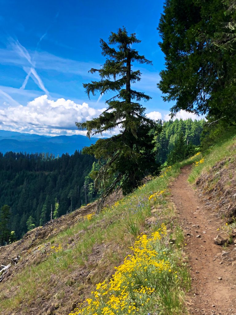
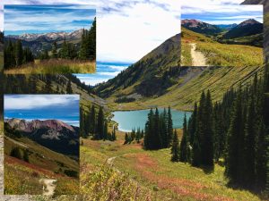
The full ride combines the Upper and Lower Alpine Trails. Starting at Kate’s Cut-In, you will begin with a relatively short climb before reaching a wide open meadow with outstanding views. After this flat section you will begin your first big descent.
From the meadow, the riding is hard to beat. Mountain bikers from around the country (and the world) come to Oakridge to ride all of its fantastic backcountry trails, but the Alpine Trails are the crown jewels. The singletrack is mostly buff, with excellent flow, so let go of your brakes and let’er rip (within your skill level, of course). You are beginning a descent of over 5,000′ over the next 11 miles.
During the next 11 miles on your way to the trail’s end in Westfir, you will do some climbing (remember, riding this trail does require 2,588′ of climbing), but you will also have numerous descents, including a 2 mile descent from the meadow and a close to 7 mile descent from the Tire Mountain junction on Lower Alpine. During the course of the 11 miles, you will come upon some road crossings and junctions to navigate. Just make sure to use Trailforks on your phone or get detailed instructions from a local bike shop or shuttle service and you should have little problem following the trail. (For safety, be sure to have a paper map and compass in your pack in case you get lost.)
Most riders finish the Alpine Trails in 1.5 to 2.5 hours. The ride is amazing, with killer views, outstanding backcountry singletrack, and ripping downhills. I LOVE this trail and I bet you will too. In an area with top notch riding, Oakridge’s Alpine Trails are a must do for every visit. Have fun!
Scroll down to learn about the GEAR WE USE and OTHER OUTVENTURES in this area.
Additional Information (Click below to follow links.)