Dazzlingly beautiful views reward those who hike to the summit of iconic Table Rock on the rim of North Carolina’s beautiful Linville Gorge.

Chris & Mac
We outventure to help you outventure!
For us, outventuring isn’t just about adventure. It’s about the quiet moments — the first light on a ridgeline, the sound of a creek at camp, the shared laughter when the trail gets spicy. We believe the outdoors enriches people’s lives, and we want to help more folks experience that connection. Learn more about us HERE.
Scroll down for full slideshow.
Length: 2.8 Miles Round Trip, Approximately
Trailhead(s): Table Rock Parking Area *
Elevation Gain: 554’
Trail Type: Out & Back
Dogs: Allowed
Difficulty: Moderate to Strenuous
Permit Required? No
Considerations: Rough Forest Service Road; * Road to Summit Closed January – March
Season: April – December
Overview
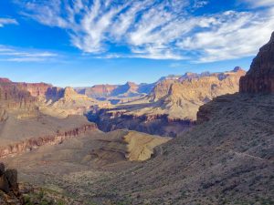
The summit of Table Rock, perched atop the rim of North Carolina’s beautiful Linville Gorge, has both amazing long views of the Blue Ridge Mountains as well as incredible views into the gorge.
TABLE ROCK HIKE
The hike up the Table Rock Summit Trail is considered moderate because it is a steady climb. Additionally, it is considered strenuous due to the final, steep push to the top. Despite this, it is manageable for most. We we were not overly bothered much by the final climb – just a little winded.
Atop Table Rock
Once at the summit the views in every direction are impressive. We had a blast wandering about the big rock to check out each and every one of them. We were careful, as you should be too, to keep our feet on rock. There is a great deal of vegetation and other organic growth tucked in and around the rocks. Because our careless footsteps up here can kill the vegetation that lives here, please do your part to keep it alive.
After our wanderings we sat for awhile to just soak it all in. From atop Table Rock the top of the world views of the gorge and its amazing geology are exceptional. Beyond the gorge, views of the elegant softness of the many peaks and folds of the Blue Ridge Mountains are spellbinding. As such, all views from here are breathtakingly beautiful. To top it off, the trail getting here is equally lovely.
Table Rock Summit Trail
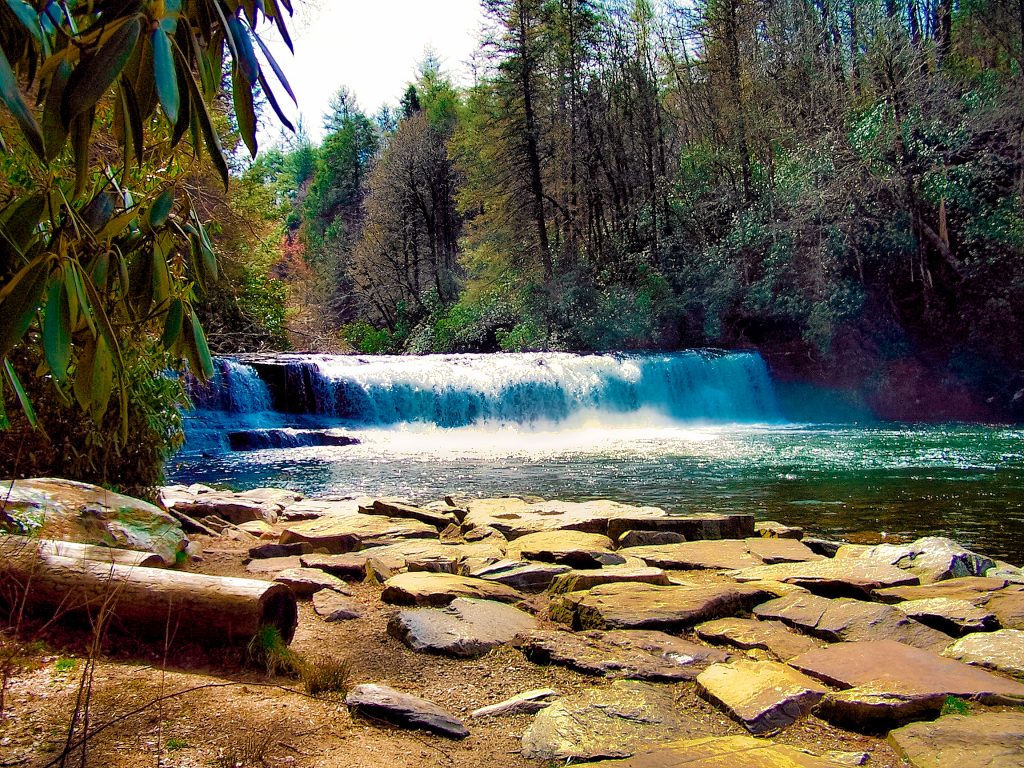
Though sometimes offering peeks of the gorge, much of the Table Rock Summit Trail is thickly lined with exceptionally pretty foliage which blocks most views. No worries, however, since the trail has much to offer. For instance, for those who love rock (like me), it has gorgeous rock both surrounding the trail and underfoot. Typical for the area, the rock adds a level of technicality to this trail making it moderately technical due to the need for some bigger steps here and there to get over rocks and roots. These areas come and go, but what does not ever leave is the gorgeous scenery that surrounds the trail and changes with the seasons.
For example, spring and summer bring with them breathtaking hues and textures. All around, thick green foliage is dotted with a delightful rainbow of wildflower blooms. Lucky summer hikers are also treated to fabulous white and pink rhododendron blossoms. In contrast, early fall finds the area dressed in brilliant hues of yellow, orange, and red, whereas in late fall and winter it wears starkly bare branches, opening up views which are hidden the rest of the year.
A BUMPY RIDE TO GET THERE
Scroll down to learn about the GEAR WE USE and OTHER OUTVENTURES in this area.
Additional Information (Click below to follow links.):
Table Rock Trail Slideshow
(Click image to expand.)
Gear We Use for Day Hiking
To see descriptions of the gear Chris & Mac use for day hiking, as well as links to manufacturers and retailers offering the gear for sale, please CLICK HERE.
Articles About Other Regional Outventures
SAFETY DISCLAIMER: The activities discussed in this website are outdoor activities and, as such, have inherent risks to which participants are exposed. It is not the intent of this website, nor is it possible due to the variability of weather, terrain, equipment, and experience, to detail all of those risks. The information contained in this site is informational, but not instructive nor exhaustive. It is the sole responsibility of the user to ensure he/she is in good health, fully prepared, and fully informed as to dangers before undertaking any of the activities discussed in this website and the user does so at his/her own risk. The user understands that by using this website he/she acknowledges and accepts all risks associated with use of information from this website and participation in any particular activity addressed herein. Please see “Terms of Use” for additional information.
Want to share this article with your friends? Click on the share button below:
Want more?
Get the latest outventure updates by following us on social media . . .