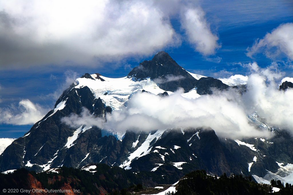
Majestic and endless panoramic views surround and delight those who hike the Skyline Divide Trail in the Mount Baker Wilderness.

Chris & Mac
We outventure to help you outventure!
For us, outventuring isn’t just about adventure. It’s about the quiet moments — the first light on a ridgeline, the sound of a creek at camp, the shared laughter when the trail gets spicy. We believe the outdoors enriches people’s lives, and we want to help more folks experience that connection. Learn more about us HERE.
Scroll down for full slideshow.
Length: Up to 9 Miles Round Trip
Trailhead(s): Skyline Divide Trailhead
Elevation Gain: Up to 2,500’
Trail Type: Out & Back
Dogs: Allowed
Difficulty: Easy to Moderate
Permit Required? Yes – $5 Day Use Fee (purchase in advance) or Valid Recreation Pass
Considerations: Black Bears, Bugs, Snow, Heavy Usage
Season: Summer-Fall
IMPORTANT CLOSURE NOTICE: Trailhead is currently not reachable due to flood damage on Glacier Creek Road #39 (closed at mile 3.8) and Deadhorse Road #37 (closed at mile 3.1.). These closures are enforced with concrete barriers put up by the forest service in early May, 2022. Information regarding repair and re-opening of these two roads is not yet available.
Overview
Majestic and endless panoramic views abound on the Skyline Divide Trail in the Mount Baker Wilderness.
THE SKYLINE DIVIDE
With unmatched views of Mount Baker and Mount Shuksan, the marvelous Skyline Divide extends to the north from Mount Baker. Because this ridge has little tree cover and sits at such a high elevation (6,000 feet) the views from it are amazing. Adding to the unbelievably spectacular and in your face views of Mount Baker and Mount Shuksan, views from the Skyline Divide also extend north into Canada, east into North Cascades National Park, and west to Puget Sound.
If exquisite, mind blowing views get your attention, then plan a hike on the Skyline Divide Trail. With breathtaking views year round and delightfully abundant wildflowers in the summer, there is absolutely nothing we don’t love about hiking this trail.
Skyline Divide Trail – Up Through the Forest
This is a moderately strenuous hike due to the steep elevation gain necessary to get up to the Skyline Divide. From the trailhead, the Skyline Divide Trail climbs about 1,500 feet (steadily and fairly steeply) through the forest for about two miles. On switchbacks weaving back and forth, hikers climb relentlessly up to the Skyline Divide.
Nearing the end of the ascent, the Skyline Divide Trail finally emerges from the forest. As it does, the snow and ice capped top of Mount Baker appears. It looms larger with each step, and the excitement grows. Once the trail tops out, however, take some time to be overwhelmed. It takes several minutes to soak it all in.
Skyline Divide Trail – Hiking the Ridge
Heading south towards Mount Baker, the Skyline Divide Trail follows the narrow ridge of the Skyline Divide. As such, it also follows the various knolls along it – both up and down. Although none of the elevation changes along the ridge are terribly long, there are a couple of steep, rocky areas to navigate. Hiking poles will provide stability and support while navigating these knolls, so be sure to bring them for this hike.
It is not long before the first of these steep, rocky knolls is encountered. First the Skyline Divide Trail descends, then it climbs, leading to a split. If keeping track, this is the second knoll – the first is where the trail initially emerges from the forest. There are six of them altogether on the Skyline Divide Trail.
To the left the trail climbs another couple hundred steep and rugged feet. This route turns the mandatory 200 foot ascent into a nearly 400 foot optional ascent. We look at the up and over route and see no benefit to making that climb. As such, like nearly everyone else hiking the Skyline Divide Trail, we go right. Consequently, instead of a gnarly climb, we are treated to wildflowers and beautiful views.
For the remainder of the hike, the views are stunning and the landscape is divine. When it is time to go, simply turn around and head back to the trailhead.
Skyline Divide Trail – Summing it Up
Hike the Skyline Divide Trail for up to 4.5 miles (one way) and see for yourself that the views just keep getting better the further you go. We hiked here in early August and wandered out a little more than three and a half miles. Our total elevation gain was 2,106 feet, our total distance was 7.2 miles. We were on the trail for just under four and a half hours, and got to our maximum penetration on the fourth knoll in 2 hours and 20 minutes. It was a clear day, and the views all around us were crazy beautiful.
There was still some patchy snow around the trail along the divide, but really none to speak of on the trail. The views were outrageously gorgeous, the wildflowers were blooming like crazy, and the summer bugs had abated. We loved hiking the Skyline Divide Trail. If you are in the area and looking for a fantastic hike, then we are pretty certain you will find what you are looking for on the Skyline Divide Trail. Outventure on!
Scroll down to learn about the GEAR WE USE and OTHER OUTVENTURES in this area.
Additional Information (Click below to follow links.)
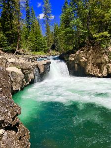
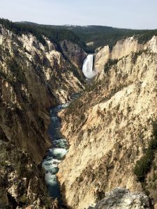
Skyline Divide Trail Slideshow
(Click image to expand.)
Gear We Use for Day Hiking
To see descriptions of the gear Chris & Mac use for day hiking, as well as links to manufacturers and retailers offering the gear for sale, please CLICK HERE.
Articles About Other Regional Outventures
SAFETY DISCLAIMER: The activities discussed in this website are outdoor activities and, as such, have inherent risks to which participants are exposed. It is not the intent of this website, nor is it possible due to the variability of weather, terrain, equipment, and experience, to detail all of those risks. The information contained in this site is informational, but not instructive nor exhaustive. It is the sole responsibility of the user to ensure he/she is in good health, fully prepared, and fully informed as to dangers before undertaking any of the activities discussed in this website and the user does so at his/her own risk. The user understands that by using this website he/she acknowledges and accepts all risks associated with use of information from this website and participation in any particular activity addressed herein. Please see “Terms of Use” for additional information.
Want to share this article with your friends? Click on the share button below:
Want more?
Get the latest outventure updates by following us on social media . . .