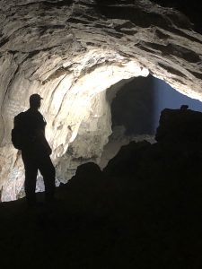
Hike the Rubicon Trail to soak in the peaceful, breathtaking scenery, and delight in views of the incredible clear blue waters of Lake Tahoe.

Chris & Mac
We outventure to help you outventure!
For us, outventuring isn’t just about adventure. It’s about the quiet moments — the first light on a ridgeline, the sound of a creek at camp, the shared laughter when the trail gets spicy. We believe the outdoors enriches people’s lives, and we want to help more folks experience that connection. Learn more about us HERE.
Scroll down for full slideshow.
Length: 12.5 Miles Round Trip
Trailhead(s): Rubicon Trailhead at Calawee Cove Beach – DL Bliss State Park
Elevation Gain: 1,110’
Trail Type: Out & Back
Dogs: Not Allowed on Trails or Beaches
Difficulty: Easy to Moderate
Permit Required? Yes – State Park Entry Fee or Valid California State Park Pass
Considerations: No Smoking on Trail
Season: Year Round (Winter Access Limited)
Overview
Soak in the peaceful, breathtaking scenery, and delight in views of the incredible clear blue waters of Lake Tahoe while hiking the Rubicon Trail.
LAKE TAHOE
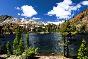
Easy access from Reno and Carson City Nevada, as well as from Sacramento, California, make beautiful Lake Tahoe a wildly popular tourist destination. This enormous lake is exceptionally pretty, and the landscape surrounding it is equally as impressive. Correspondingly, people flock to Lake Tahoe year round to recreate and explore.
Driving around the lake in some places makes it appear that a great deal of the area immediately surrounding the lake has been developed for commercial or private use. In reality, much of it remains largely untouched. This is because approximately 78% of the land surrounding Lake Tahoe is protected and managed by the US Forest Service. Additionally, within these protected lands there are five designated wilderness areas.
Further protections around this gorgeous lake are due to the efforts of the states of California and Nevada. Along the 72 mile long shoreline of Lake Tahoe, there are several state parks which protect and preserve its sensitive shorelines and surrounding areas.
Although highly protected, the good news for outdoor enthusiasts is that all of these federal and state areas are accessible. On the southwest side of Lake Tahoe, for example, the Rubicon Trail follows the magnificent shoreline that lies within the boundaries of two gorgeous state parks.
DL BLISS STATE PARK AND EMERALD BAY STATE PARK
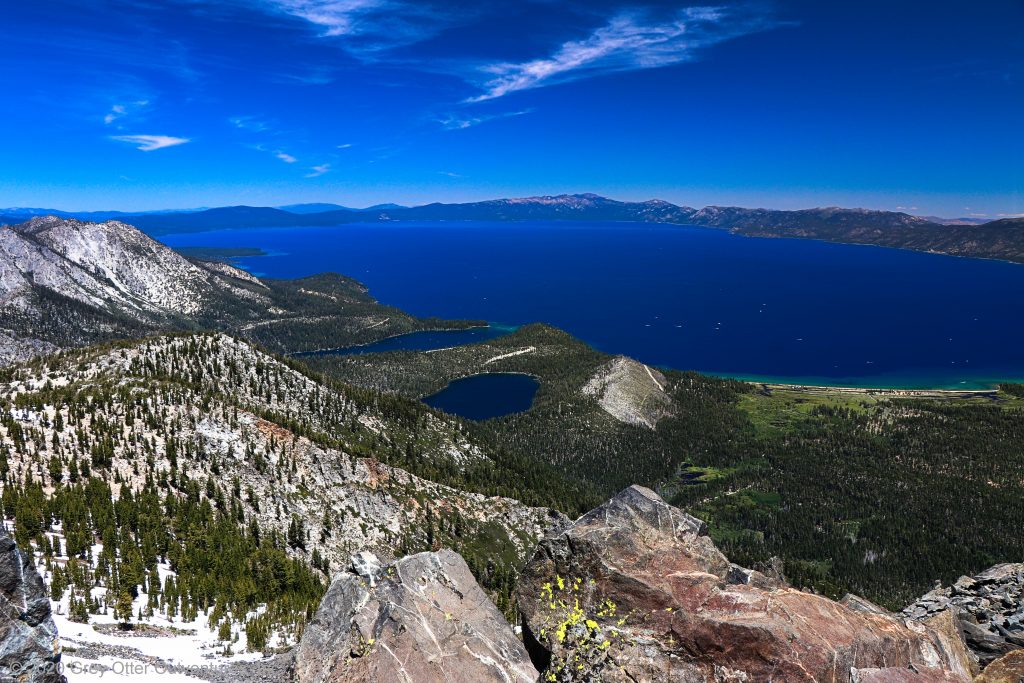
Combined, the DL Bliss and Emerald Bay State Parks protect 1,830 acres along 6 miles of Lake Tahoe’s shoreline on the California side of the lake. Because they directly abut each other, they preserve an exceptionally long and lovely stretch of Lake Tahoe shoreline.
The large cove of Emerald Bay is fully protected within the boundaries of Emerald Bay State Park – all the way from Eagle Point to Emerald Point. Emerald Bay State Park ends just after Emerald Point. However, since it meets up with the boundary of DL Bliss State Park the transition is seamless. As such, protections continue northward to beyond Calawee Cove Beach. Because they encompass so much of the shoreline as well as the immediately surrounding area, the scenery within these two parks is outstanding.
From the rocky cliffs above the lake all the way down to lake level, there are many opportunities to enjoy these two parks. For those who like to explore on foot, a leisurely hike along the Rubicon Trail exposes every bit of this loveliness.
RUBICON TRAIL
The Rubicon Trail has multiple access points. Two are in Emerald Bay State Park and two more are in DL Bliss State Park. Because we wanted to explore the entirety of the trail, we chose to start at Rubicon Point in DL Bliss State Park. Our hike on the Rubicon Trail thus took us both above and along the shoreline to Emerald Point, down and around Emerald Cove, and then up to Eagle Point. Despite being rocky at times, this trail is not technical and is mostly firmly packed dirt.
There is some elevation gain on the Rubicon Trail, but this is because the trail follows the natural terrain around the lake. Thus we move fairly gently up and down through a large part of this hike. The longest, steepest part occurs over the half mile between Eagle Falls and the Upper Eagle Point Campground.
Taking our time since we were in no hurry and wanted to soak, soak, soak this one in, we covered the 12.5 mile round trip in 5.75 hours. This is a pretty slow pace for us, but it is understandable because we stopped so many times for photos and general gawking at the pretty scenery. It’s simply not possible to do otherwise. This lake is unbelievably gorgeous!
Trailhead to Emerald Point
The parking area above Calawee Cove Beach is where we begin our hike on the Rubicon Trail. From the parking area at the trailhead we immediately have great views of Lake Tahoe. As soon as we see them we get stoked, and we eagerly set forth on the Rubicon Trail.
Soon after departing the trailhead we encounter a series of stone steps leading us higher above the lake. Before long we reach a point where the Rubicon Trail gets narrow as it skirts around gigantic boulders on our right. On the left, a protective rail keeps hikers on the trail and away from the steep cliffs.
For about a mile we look out over trees and boulders and take lots of time to gawk at the awesome views. Yup, this is the Lake Tahoe we came to see and we are grinning from ear to ear. After taking time to check out the old lighthouse viewpoint, the trail leads us into the forest. Following this lovely wooded stretch, the Rubicon Trail ditches the tree cover and views open up once again.
Finally dropping down near the water, the trail follows the shoreline around several small coves. They are breathtakingly lovely, and the shallow waters glow a brilliant aqua blue. It is dazzlingly beautiful, and we thoroughly enjoy hiking this section of the trail. Upon reaching Emerald Point, the Rubicon Trail briefly takes us inland once again.
Emerald Bay, Vikingsholm, & Eagle Falls
After rounding Emerald Point, the Rubicon Trail stays down near the lake as it circles around Emerald Bay. We get lots of great views from the trail – with little company. However, as we pass through the Boat Camp we encounter more people.
Before reaching Emerald Bay we did have some company on the trail, but most of it fell off after the old lighthouse viewpoint. Upon getting to Emerald Bay, however, the trail got quite busy. This is because of the one mile Vikingsholm Trail that provides access to the Rubicon Trail from the Vikingsholm parking area on Highway 89. It is a steep trail that intersects the Rubicon Trail near the head of Emerald Bay.
For those who access the Rubicon Trail here, it is only a short stroll to one of the very first summer homes at Lake Tahoe. Built in 1929 as a summer retreat, Vikingsholm, was acquired by the state of California in 1953. In the summer it is open for tours.
Before getting to Vikingsholm, however, the Rubicon Trail passes by a roped off swimming area. On our way through we see plenty of people hanging out and enjoying the beach, but few are in the cold water even though it is mid-June. Immediately following the swimming area we pass by Vikingsholm, and then arrive at the foot of Eagle Falls.
The Eagle Falls Trail junctions in here and leads to the top of Eagle Falls. As we pass by there are quite a few people exploring the waterfall run and climbing up to view the falls. Once we depart this lower area of the falls, however, we leave nearly all of this activity behind.
Eagle Falls to Upper Eagle Point Campground
The steepest part of the Rubicon Trail is between Eagle Falls and the Upper Eagle Point Campground. Once it starts ascending it gains about 260 feet over roughly a half mile. Views are through the trees, but because the trail is once again above the lake we can see Emerald Bay in its entirety. Emerald Point juts out on the far side of the mouth of Emerald Bay, Fannette Island is in full view below us, and we can see well beyond Emerald Bay into Lake Tahoe.
The Rubicon Trail ultimately terminates at a road. There is an informational sign about Vikingsholm and a small amphitheater. To the right the road leads to the Upper Campground whereas to the left it leads to the Lower Campground. We have no interest in visiting these campgrounds so having completed the full length of the Rubicon Trail we are done making forward progress. We poke around briefly and then turn around to retrace our steps.
The Return
Before we get back down to Eagle Falls we pull off the trail for a lunch break. It is quiet, and only a few other hikers pass by while we sit quietly eating and admiring Emerald Bay. Back down near Eagle Falls I decide to count the small bridges over the many streams feeding the lake around the head of the bay. After the first dozen or so I lose count and abandon my effort. All I can say is that that there are a whole lot of them.
Once we get back in the vicinity of Eagle Falls and Vikingsholm we move through the area as quickly as possible. It is now mid afternoon and it is pretty crowded. Thankfully, the farther away we get from Emerald Bay we find that the trail traffic decreases once again. The reverse is true as we near the old lighthouse viewpoint, and once we get to that area we once again encounter many other hikers on the trail.
The views are just as spectacular heading back towards DL Bliss State Park as they were on our hike out. It did not matter if we were overlooking the lake from above or walking along its shore – we simply never tired of looking at beautiful Lake Tahoe.
Scroll down to learn about the GEAR WE USE and OTHER OUTVENTURES in this area.
Additional Information (Click below to follow links.)
Rubicon Trail Slideshow
(Click image to expand.)
Gear We Use for Day Hiking
To see descriptions of the gear Chris & Mac use for day hiking, as well as links to manufacturers and retailers offering the gear for sale, please CLICK HERE.
Articles About Other Regional Outventures
SAFETY DISCLAIMER: The activities discussed in this website are outdoor activities and, as such, have inherent risks to which participants are exposed. It is not the intent of this website, nor is it possible due to the variability of weather, terrain, equipment, and experience, to detail all of those risks. The information contained in this site is informational, but not instructive nor exhaustive. It is the sole responsibility of the user to ensure he/she is in good health, fully prepared, and fully informed as to dangers before undertaking any of the activities discussed in this website and the user does so at his/her own risk. The user understands that by using this website he/she acknowledges and accepts all risks associated with use of information from this website and participation in any particular activity addressed herein. Please see “Terms of Use” for additional information.
Want to share this article with your friends? Click on the share button below:
Want more?
Get the latest outventure updates by following us on social media . . .