One of Oregon’s 7 wonders, Smith Rock State Park is a gem! Located near Bend, the park offers hikers amazing scenery and geologic marvels.

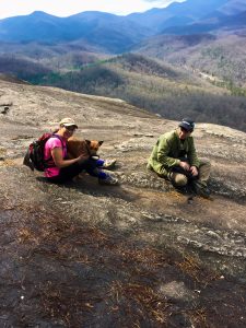
Chris & Mac
We outventure to help you outventure!
For us, outventuring isn’t just about adventure. It’s about the quiet moments — the first light on a ridgeline, the sound of a creek at camp, the shared laughter when the trail gets spicy. We believe the outdoors enriches people’s lives, and we want to help more folks experience that connection. Learn more about us HERE.
Scroll down for full slideshow.
Length: 10 Trails in the Park with a Total Mileage of 14.8 Miles
Trailhead(s): Smith Rock State Park
Elevation Gain: Varies Based on Selected Trails and Routes
Trail Type: System
Dogs: Allowed on Leash
Difficulty: Easy to Advanced
Permit Required? No
Considerations: Parking fee is $5 per Vehicle
Season: Year Round
Overview
Designated as one of the seven wonders of Oregon, Smith Rock State Park is a gem. Just a short drive from Bend in central Oregon, Smith Rock offers visitors a unique experience and the ability to hike, mountain bike, rock climb, and see wildlife (including bald and golden eagles). In this article, our focus is the excellent hiking offered by Smith Rock State Park.
What Makes Smith Rock State Park Unique?
Jetting out of the high desert in central Oregon, the jagged rocks of Smith Rock State Park seem to come out of nowhere. The rocks of the Park are volcanic in nature, made of tuff and basalt deposited over the eons. Later cutting through the tuff and basalt, the Crooked River created the canyon that makes the park so beautiful and created canyon walls as high as 600 feet. These geologic features are complimented with outstanding views of the entire central Oregon Cascade range.
The sheer beauty and uniqueness of Smith Rock State Park is amazing. When combined with 14.8 miles of well maintained trails, the opportunity to see climbers scaling the sheer walls of the park on one of a thousand climbing routes, and abundant opportunities to see wildlife such as bald or golden eagles, Smith Rock State Park is an outstanding choice for a day of hiking in central Oregon.
Hiking at Smith Rock State Park
The 10 trails at Smith Rock State Park, covering 14.8 miles, offer hikers plenty of trail for a full day of hiking. The trails are exceptionally well built, maintained, and marked. The trails are structured to offer opportunities for numerous circuits and loops of varying lengths. Hikers can hike on either side of the Crooked River at the bottom of the canyon or at the summit of the rocky peaks above the river.
Smith Rock State Park has 4 “Easy” trails, 4 “More Difficult” trails, and 2 “Most Difficult” trails. This variety enables the park to offer something for all levels of hikers, from beginner to experienced.
For visitors who merely want to see the beauty of the canyon without doing an extensive hike, they can take an easy stroll down the Rim Rock Trail. If a longer easy hike is desired along the Crooked River, the 1.2 mile Wolf Tree Trail or the 2.2 mile River Trail are excellent hikes.
For those who want to up their game a little, the 2.2 mile Summit Trail offers excellent views of the Park. The trail is accessed from the River Trail and can be hiked as an out & back or can be combined with Burma Road and the Wolf Tree Trail for a 7.2 mile loop (see the Smith Rock State Park trail map link below).
Then, there is the Misery Ridge Trail. For those who want or are comfortable with a more rigorous hike, it can be done as an out & back, accessed from the Chute Trail, or as part of a loop. If you want to experience a little of everything the Park has to offer, and some of the Park’s most beautiful scenery and views, then read on about Smith Rock State Park’s popular Misery Ridge Loop.
The Most Popular Hiking Loop at Smith Rock State Park
The most popular loop at Smith Rock State Park is the 4 mile Misery Ridge Loop. Although somewhat short compared to hikes in other locations in the central Cascade mountains, the hike is outstanding. It takes hikers up from the Crooked River to the top of Misery Ridge, then back down to the river on the back side of the ridge.
Along the Misery Ridge Loop, hikers climb a somewhat steep, but fun, trail to the ridge top where they get fantastic views of central Oregon and, on a clear day, the entire central Oregon Cascade range. Traveling along ridge, the Misery Ridge Loop ultimately descends past the Park’s famous “Monkey Face” rock structure down a rocky trail back to the Crooked River on the backside of the ridge.
Upon returning to the Crooked River, it is a beautiful 2.1 mile river hike on the Mesa Verde and River trails back to the start, passing amazing rock walls that tower as much as 600 feet above the river. Along the way, hikers are likely to see a variety of wildlife, including ducks floating in the river and bald eagles soaring high above the rock walls.
If you go to Smith Rock State Park, do not miss this loop hike!
Conclusion
We can’t stress enough that a visit to Smith Rock State Park should be on the agenda of every hiker visiting Bend or central Oregon. The Park is extremely user friendly, the scenery is beautiful, the geology is amazing, and the visit is a blast for adults and children alike. Trust us, it will be among the best value you have ever received for your $5 cost of entry!
Scroll down to learn about the GEAR WE USE and OTHER OUTVENTURES in this area.
Additional Information (Click below to follow links.)
Smith Rock State Park Slideshow
(Click image to expand.)
Gear We Use for Day Hiking
To see descriptions of the gear Chris & Mac use for day hiking, as well as links to manufacturers and retailers offering the gear for sale, please CLICK HERE.

Articles About Other Regional Outventures
SAFETY DISCLAIMER: The activities discussed in this website are outdoor activities and, as such, have inherent risks to which participants are exposed. It is not the intent of this website, nor is it possible due to the variability of weather, terrain, equipment, and experience, to detail all of those risks. The information contained in this site is informational, but not instructive nor exhaustive. It is the sole responsibility of the user to ensure he/she is in good health, fully prepared, and fully informed as to dangers before undertaking any of the activities discussed in this website and the user does so at his/her own risk. The user understands that by using this website he/she acknowledges and accepts all risks associated with use of information from this website and participation in any particular activity addressed herein. Please see “Terms of Use” for additional information.
Want to share this article with your friends? Click on the share button below:
Want more?
Get the latest outventure updates by following us on social media . . .