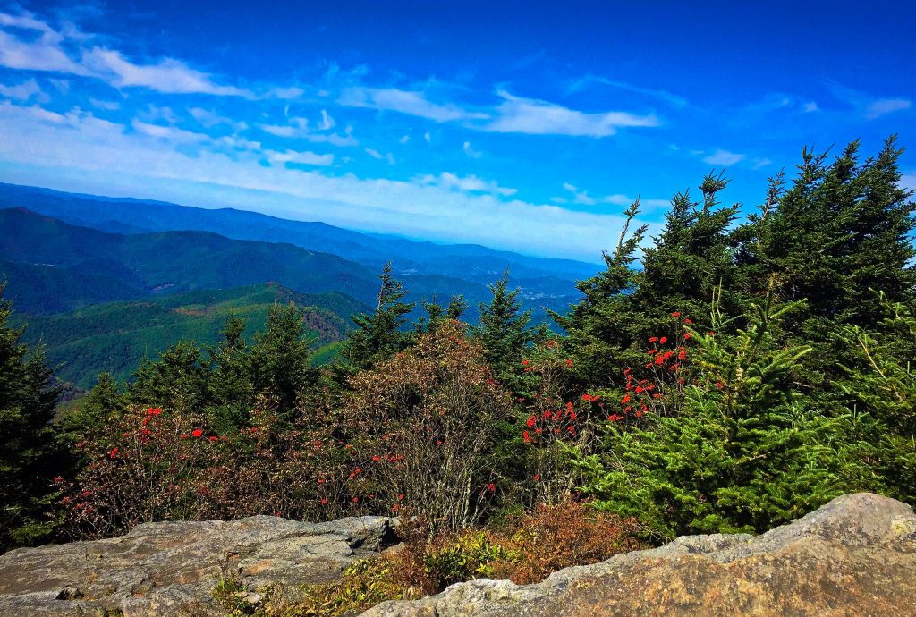
Want a fantastic adventure with spectacular views of the Blue Ridge Mountains? Hike the Deep Gap trail in North Carolina’s Mount Mitchell State Park.
Chris & Mac
We outventure to help you outventure!
For us, outventuring isn’t just about adventure. It’s about the quiet moments — the first light on a ridgeline, the sound of a creek at camp, the shared laughter when the trail gets spicy. We believe the outdoors enriches people’s lives, and we want to help more folks experience that connection. Learn more about us HERE.
Scroll down for full slideshow.
Length: 9 Miles Round Trip
Trailhead(s): Mount Mitchell State Park – Summit Parking Lot Picnic Area
Elevation Gain: 3,000’
Trail Type: Out and Back
Dogs: Allowed
Difficulty: Moderate to Strenuous
Permit Required? No
Considerations: Bears
Season: Year Round / Road closures may be encountered during winter months.
Overview
Want a fantastic adventure with spectacular views of the Blue Ridge Mountains? Hike the Mount Mitchell State Park Deep Gap Trail. It’s one of our favorites!
HIKING TO DEEP GAP
The Black Mountain Crest Trail to Deep Gap
Departing from the picnic area near the Mount Mitchell summit where NC-128 terminates, the Deep Gap trail follows the Black Mountain Crest Trail though a forest of spruce and balsam firs. The aroma of sweet pine combined with the beauty of the vibrant mosses and ferns make this initial portion of the trail especially pleasing.
Emerging from the pleasant mossy woods, the trail descends rapidly via a series of steps. Lot’s of them! Once the steps are in the rear view mirror, the trail works its way over multiple peaks on the way to the meadows of Deep Gap. That means this hike has a lot of elevation gain. Even so, this trail is fun for those who enjoy hiking more technical and rugged trail.
Rock scrambles and steep drops and climbs through technical sections of trail are the norm for this hike. In many places there are ropes or ladders that provide assistance in the sketchier areas. Most importantly, even with the help of ropes and ladders, some stretches are strenuous, so please exercise care.
Big Tom, Mount Craig, and Other Mountain Peaks
Although the Black Mountain Crest trail continues on for several more miles, most day hikers stop at the meadows of Deep Gap to take a break before going back. Therefore, even though the hike back is only about 4.5 miles, the elevation changes are taxing. Therefore, definitely take time to re-fuel and hydrate. When refreshed and ready to go, turn around and tackle the climbs back up and over Potato Hill, Cattail Peak, Balsam Cone, Big Tom and Mount Craig. After getting back over those, take a breather because you still have the final climb up many steps to get back to the picnic area below the summit of Mount Mitchell.
WEATHER ON MOUNT MITCHELL
Even in the warmth of summer, the high elevation of this hike often means chilly temperatures and rapidly changing weather conditions. As such, the park advises that all hikers need to be prepared with appropriate clothing and equipment for both comfort and safety. Having encountered both warm and chilly conditions on our hikes along the Deep Gap trail, we concur. Be safe and have fun!
Scroll down to learn about the GEAR WE USE and OTHER OUTVENTURES in this area.
Additional Information
Mount Mitchell Deep Gap Trail Slideshow
(Click image to expand.)
Gear We Use for Day Hiking
To see descriptions of the gear Chris & Mac use for day hiking, as well as links to manufacturers and retailers offering the gear for sale, please CLICK HERE.

Articles About Other Regional Outventures
SAFETY DISCLAIMER: The activities discussed in this website are outdoor activities and, as such, have inherent risks to which participants are exposed. It is not the intent of this website, nor is it possible due to the variability of weather, terrain, equipment, and experience, to detail all of those risks. The information contained in this site is informational, but not instructive nor exhaustive. It is the sole responsibility of the user to ensure he/she is in good health, fully prepared, and fully informed as to dangers before undertaking any of the activities discussed in this website and the user does so at his/her own risk. The user understands that by using this website he/she acknowledges and accepts all risks associated with use of information from this website and participation in any particular activity addressed herein. Please see “Terms of Use” for additional information.
Want to share this article with your friends? Click on the share button below:
Want more?
Get the latest outventure updates by following us on social media . . .


